Mountain climbing is supposed to be steep, treeless and arduous. But not at Patterson Mountain, a forgotten peak half an hour’s drive from Eugene. The 2.3-mile trail to the summit is virtually level. At times you actually go downhill. The biggest old-growth forest is near the top, with groves of trees 6 feet in diameter. Yes, there’s a view, and wildflowers, and even a rustic shelter. If you like hikes more than climbs, you’ll appreciate that Patterson is a mountain built backwards.
The trick is that you first have to do nearly 4,000 feet of climbing on a gravel road, either in a car or on a bike.
Start by driving Interstate 5 south of Eugene two miles to Oakridge exit 188A. Then follow Willamette Highway 58 east for 24.7 miles. Alongside Lookout Point Reservoir, between mileposts 24 and 25, turn right on gravel Patterson Mountain Road 5840 for five uphill miles. To stay on Road 5840 you’ll need to ignore a spur to the right at the 0.3-mile mark, and keep to the right at forks from then on.
At the 5-mile mark on Patterson Mountain Road you’ll reach a large, signed junction at Patterson Saddle. Turn left on Road 1714, following a pointer for “Holland Point Jct.” After 3.1 miles, at another saddle with a four-way junction, turn left on Road 5847 for a mere 0.1 miles, then fork left on Road 555 for 0.4 miles.
A trailhead sign on the left announces the Lawler Trail. A parking pullout on the right has room for three cars. If you have a GPS app, the location here is 43.7591-122.6191.
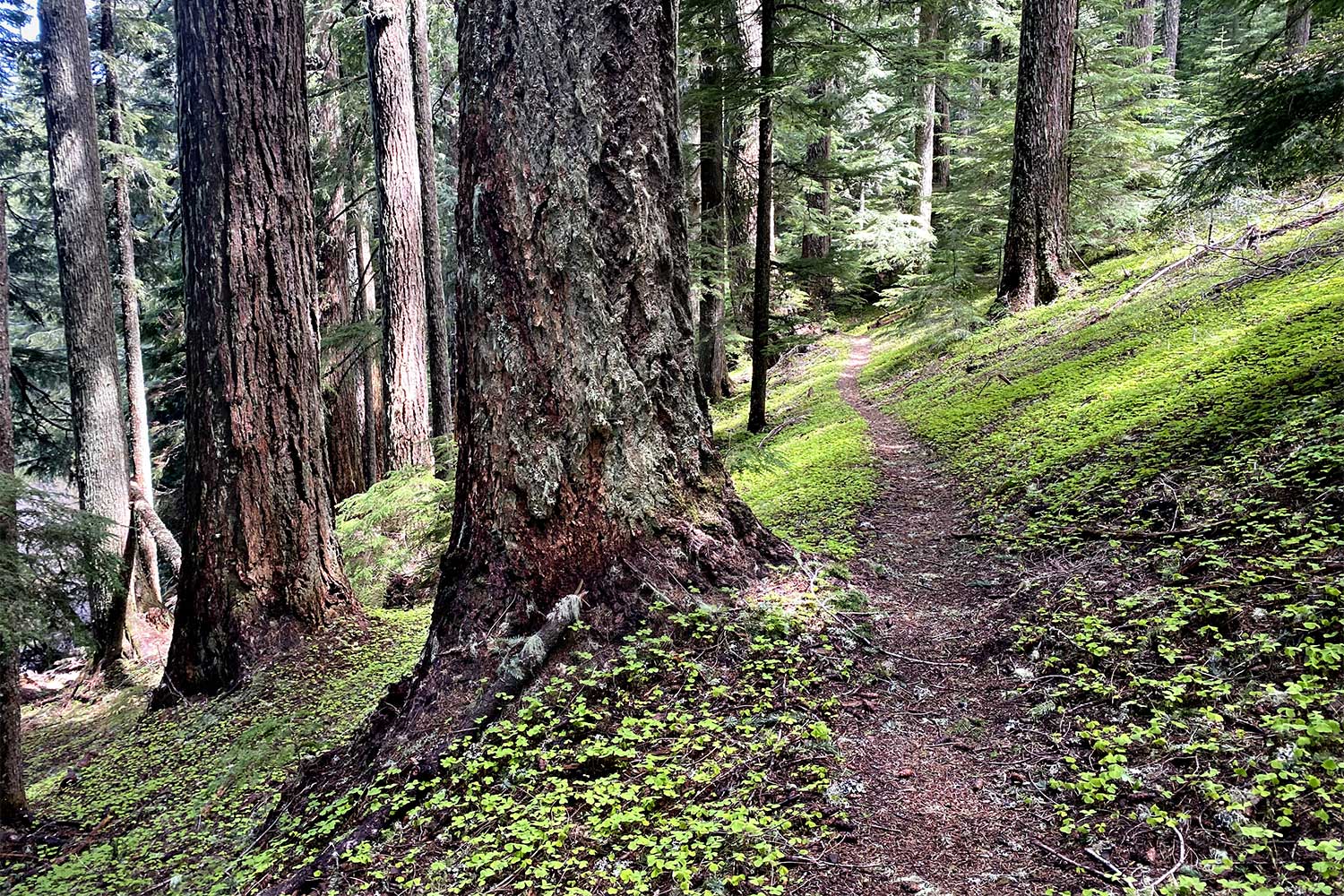
Set out on the Lawler Trail, at first through a youngish forest with rhododendrons that bloom in June. Soon the path enters old-growth woods with giant Douglas firs and hemlocks. Summer wildflowers here include vanilla leaf, star-flowered solomonseal, bleeding heart and queen’s cup.
Mountain bikers use this first part of the trail quite a bit. They are mostly doing a difficult 23-mile loop, having parked at a Highway 58 pullout near milepost 24. From there they ride their bikes east on the highway shoulder for five miles and then climb up Krueger Rock Road 5847 for 8 steep miles to the upper trailhead.
If you’re hiking, you’ll leave nearly all the bicycles behind at a fork after 0.7 miles. A sign here points to the right for the Lawler Trail, the 9.5-mile bike trail down to Highway 58. If you’re on foot, follow a “shelter” pointer to the left for the Patterson Mountain Trail.
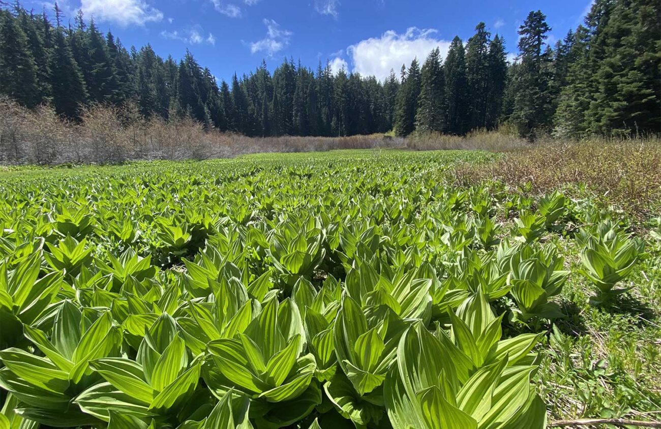
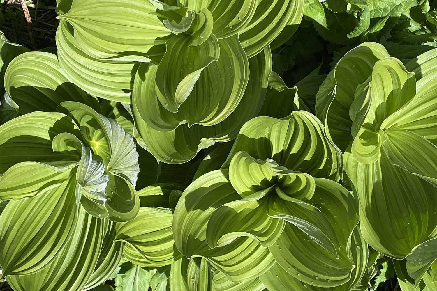
Soon after the junction you’ll see glimpses of Lone Wolf Meadow to the right. You have to bushwhack 50 feet if you want to explore this field of hellebore and wild yellow iris, but it’s worth it. Hellebore fills the field like corn plants on steroids.
Hellebore root is a drastic poison, and according to Native American lore, one of the most potent of all magic herbs. According to some, merely carrying the root about your neck can spare you from the ravages of the Land Otter People, who delight in stealing away men’s minds, leaving them pitiable half-men, half-beasts. If you are spearing seals at night and a sea monster rises up, remember to spit hellebore root at it. The monster should vanish.
Another hint: If a land monster has chewed up your neighbor’s family, try rubbing some of the root on their mangled bodies. There’s a chance they’ll pop back to life.
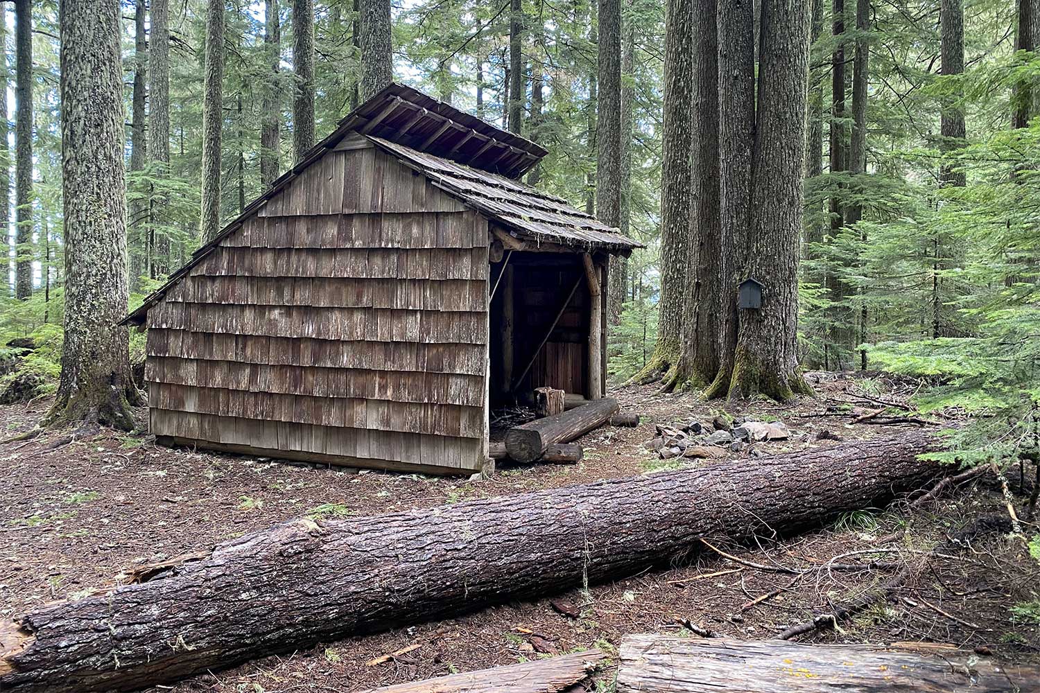
Emboldened by your encounter with hellebore, continue on the trail 0.3 miles to an unsigned fork in deep woods. First detour to the right 200 feet to find Lone Wolf Shelter. Originally built for rangers on horseback, this shake-covered, three-sided structure was entirely reconstructed in 2004, using historically accurate materials.
Then go back to the fork to continue on the Patterson Mountain Trail. Considering that this is a mountain climb, this 1.3-mile section of the hike is strangely level. The path ambles to a forested summit, dips to a small meadow, and ambles again to Patterson Mountain’s rocky clifftop.
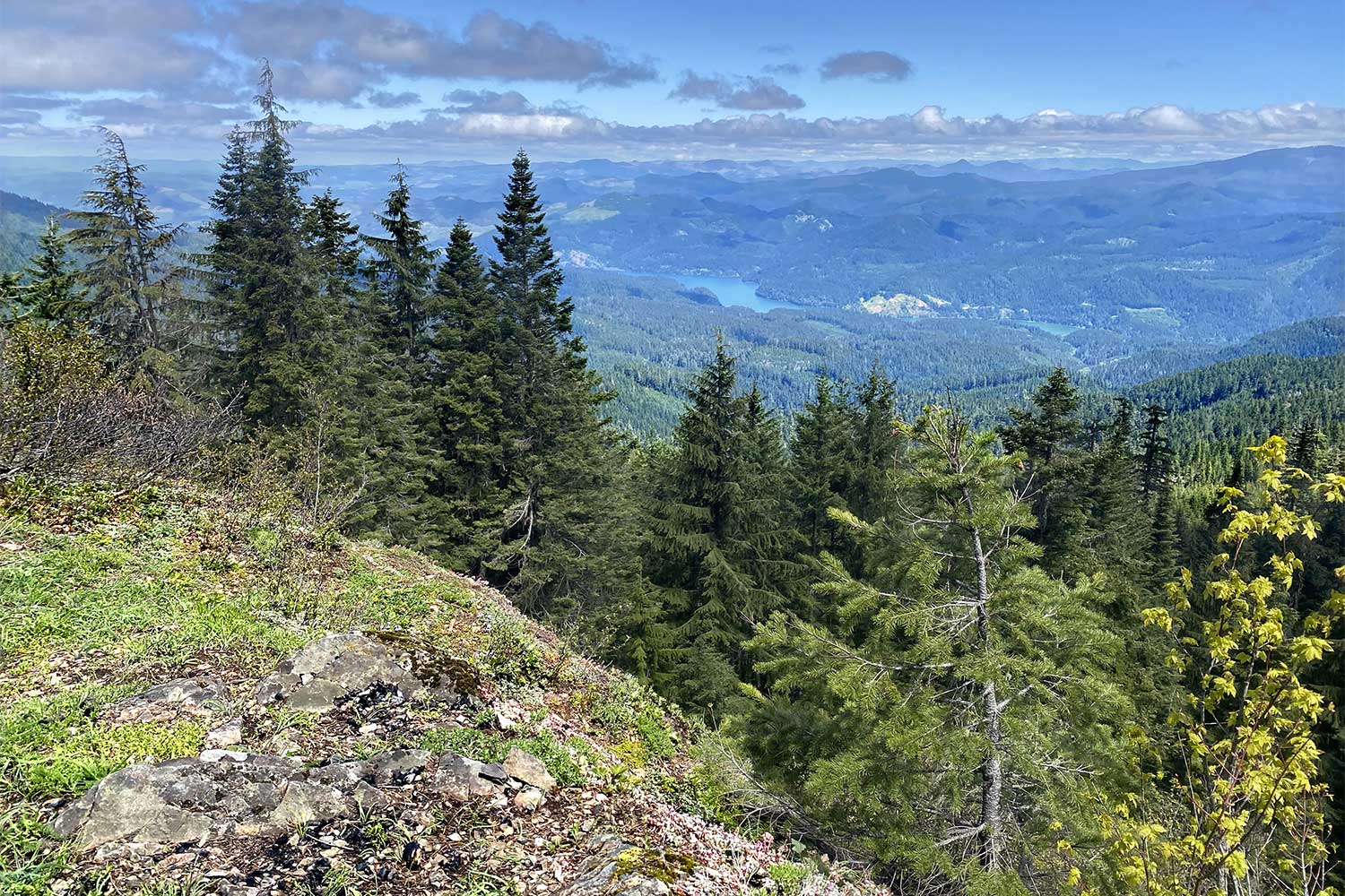
Views extend across the treetops from Hardesty Mountain to the Lookout Point Reservoir. Yellow stonecrop and wild onions dot the rocky crest — a nice spot for a picnic before turning back.
Just remember to save some energy for the hike back to your car. Because you’re likely to think that Patterson Mountain is built upside-down.
William L. Sullivan is the author of 23 books, including The Ship In The Woods and the updated 100 Hikes Series For Oregon. Learn more at OregonHiking.com.
