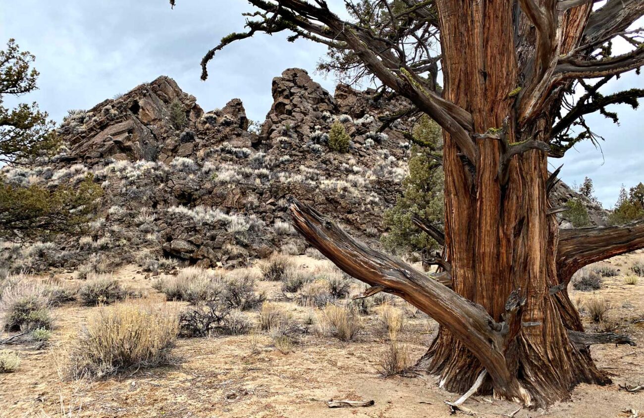
The Oregon Badlands is the strangest wilderness in Oregon, with no mountains, lakes or streams. This desert landscape east of Bend was buried by a basalt lava flow about 10,000 years ago. As more lava welled up it buckled the cooled lava crust on top into pressure ridges. Then in 5677 BC, the Mount Mazama eruption that created Crater Lake dumped a foot of volcanic ash here, filling the gaps between the pressure ridges with what look like sandy paths.
The result is a lonely labyrinth of random lava walls in a sagebrush desert sparsely dotted with juniper trees, some of them 1,000 years old. Viewpoints are few. If you wander off the official trails — old dirt roads now closed to vehicles — it is easy to get lost.
Much of the area’s charm is simply the solitude of this arid maze. But there are also three genuine destinations. Flatiron Rock, three miles from the Flatiron Rock Trailhead, is a natural lava castle in the desert, complete with walled ramparts and rock windows. The Dry River Channel, 1.4 miles from the Badlands Trailhead, is a narrow canyon where an Ice Age river once flowed.
I’m going to recommend that you seek out the third, less visited destination in this labyrinth: Badlands Rock.
The tallest point in the middle of the wilderness, this 200-foot-tall outcrop looks like a gigantic cracked egg. Most of the runny basalt lava that flooded this area welled up from a vent here. In places, the lava was so soupy that it left semicircular ripple marks, like cake batter poured in a pan. At Badlands Rock, the last of the erupting lava must have been stiffer because it bulged up into a weird, cracked butte.
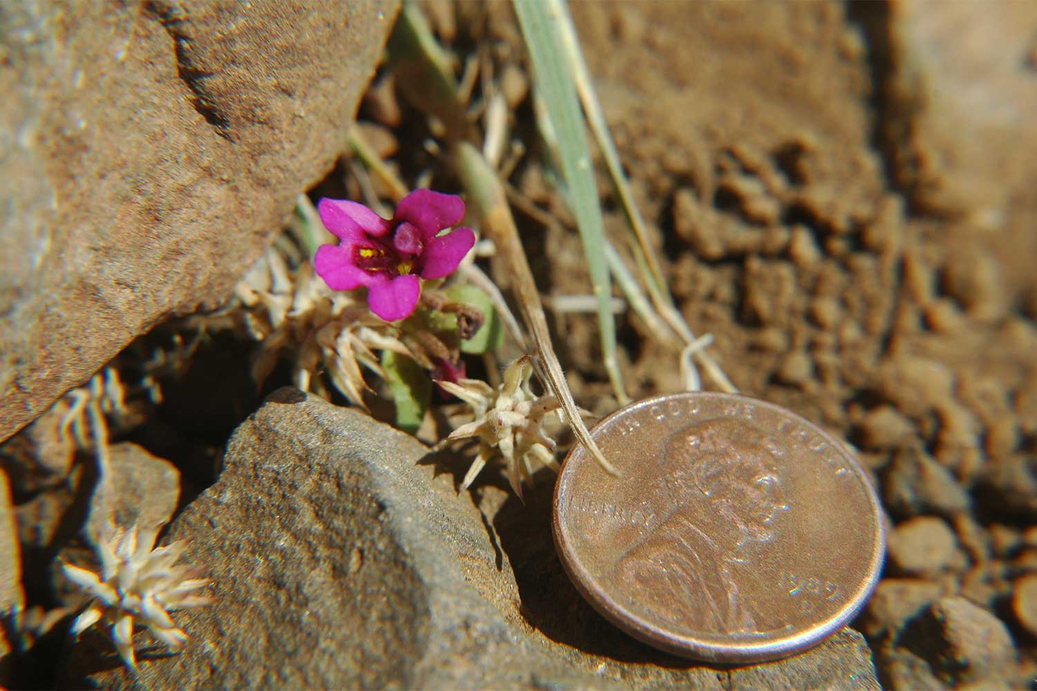
It rarely rains or snows in this desert, so you can hike here year-round. In winter, come prepared for cold winds. In summer, bring a sun hat, sunscreen and lots of water. Tiny purple monkeyflowers bloom from the sand in April and May. In September and October, rabbitbrush fills the desert with yellow flowers. In any season, take a picture of the map at the trailhead so you can find your way back to your car. A compass or a GPS app on your phone will help a lot.
To start, drive east of Bend on Highway 20 toward Burns for 18 miles. At an “Oregon Badlands Wilderness” sign at the bottom of a hill, turn left on a paved road for one mile. Then turn left into the fenced gravel Badlands Rock Trailhead.
From the Badlands Trailhead walk the wide, sandy trail 0.3 miles to a four-way junction beside a homestead site. Pause here to explore the sagebrush area to the left. You’ll find a wire fence protecting an ancient water cistern. There are also rusty artifacts here from pioneer days. Resist the temptation to pick them up. Anything more than 25 years old is strictly protected by federal law.
Leave artifacts as you found them, so that others can see them as well.
At the homestead junction go straight on the Badlands Rock Trail. For the next 2.7 miles you’ll cross a desert plain with gnarled juniper trees. Winds have twisted the ancient trees like dishrags. Evidently, the trees are stronger and less likely to break in the wind if they spiral.
At the three-mile mark you’ll reach a signed junction at the base of Badlands Rock. What you want here is a view, because you haven’t seen much so far other than sky and desert. Scaling Badlands Rock from this side, however, is really difficult. So take the trail to the right in search of an easier way. After 200 feet veer left on a sandy route that climbs a slot where the butte cracked in half. Near the top the path turns right along a different crack. This one leads you to the lunch spot you have been seeking — a ledge with a panoramic view across the desert to a string of snowy Cascade volcanoes, with the Three Sisters front and center.
The traditional prize for successfully finding one’s way through a maze is a piece of cheese. You might bring one along to celebrate at this viewpoint in the middle of the confusing, eerily beautiful Oregon Badlands Wilderness.