Whether you love hiking for exercise, for the views of waterfalls or mountains, to discover new places or just to commune with nature — experiencing Oregon’s landscapes on foot is a great way to go. In this monthly(ish) column, I hope to offer Eugene Weekly readers opportunities to have amazing hiking experiences.
That’s not all. As an advocate for wild lands, pristine waters and ancient forests, I will also offer some inspiration to learn more about the featured hikes and encourage involvement in giving back to the landscapes that offer us all so much.
Fifty-one years ago this October, Congress passed the Wild and Scenic Rivers Act. The law has the simple purpose of protecting the character of free-flowing rivers and streams with special natural values. In the last half-century, more than 2,100 miles of Oregon’s most-pristine waterways (and a half-mile-wide protected corridor) have been added to this prestigious club.
The protections afforded these rivers are not just great for water quality and fish habitat; recreation lovers also win. For hikers in particular, Wild and Scenic River corridors offer some of the best trails in the state, from the upper Clackamas and McKenzie rivers to the Illinois, and from the Metolius to the Imnaha.
Still more of Oregon’s rivers and streams are eligible, and deserving, of Wild and Scenic protections. Luckily, this is a priority of Oregon’s Sen. Ron Wyden, who recently issued a call to hear from the public about special rivers he could add to the system. Input can be provided by emailing rivers@wyden.senate.gov; learn more at tinyurl.com/ORwsrivers.
While many river lovers are familiar with the stunning Wild and Scenic lower Rogue River (think multi-day raft and backpacking trips west of Grants Pass), the upper Rogue Wild and Scenic stretch begins where the river gushes out of the side of ancient Mount Mazama (now known as Crater Lake) and runs for 41 miles, cutting through lava flows and passing spectacular ancient forests.
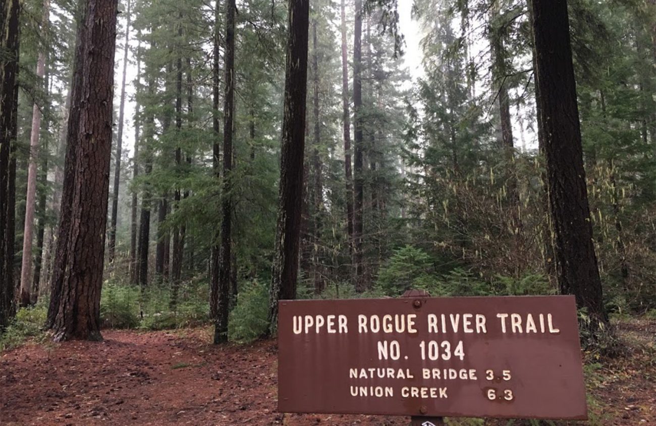
The upper Rogue River trail runs for 47 miles along and beyond the Wild and Scenic corridor. The Rogue Gorge and Takelma Gorge stretches of the trail are easy day-hikes, and make great destinations in the shoulder season between the summer hordes visiting Crater Lake National Park and winter snows. At just about 3,000 feet in elevation, the area is accessible much of the year.
To get to the upper Rogue River from Eugene, travel to the junction of Oregon Highway 138 and Oregon Highway 230 on the northwest corner of Crater Lake National Park. Follow 230 south of this junction for 25 miles to the Rogue Gorge Day Use Area, just north of the Union Creek Resort, on the right. (No permits are required for parking or hiking here, and restrooms are available.)
The Rogue Gorge area is a popular and well-marked stop for travelers on Oregon Highway 62. The paved path to the gorge viewpoint is just a quarter-mile loop, but for a spectacular forest hike keep following the river downstream on the unpaved trail once you’ve taken a look at the gorge.
The trail passes cabins accessed from the Union Creek area, with views of the river and huge Douglas-fir and pines. Vine maple, western hemlock, Pacific yew and chinquapin fill in the understory. A little more than a mile down the trail, you’ll cross Union Creek where it enters the Rogue. Turn back here for a 2.5-mile hike, or make it a loop by turning left and following the trail through the Union Creek Campground toward the highway, then walk along the highway shoulder a short way past Union Creek resort and back to the Rogue Gorge parking area.
Continue 4.5 miles south of the Rogue Gorge on 62 to find the next hike to Takelma Gorge. Turn west off of 62 between mileposts 51 and 52 onto Forest Road 68. Drive 1.8 miles and pull over at the Woodruff Bridge trailhead parking area on the left just before a bridge over the river.
Follow the trail downstream through a tunnel of vine maple. Gigantic Douglas-firs, six to seven feet in diameter, tower overhead. The river takes a big bend where it is eroding the bank and offers views of the ancient forest on the other side as well. In about 1.5 miles, you’ll come to the first view of Takelma Gorge, where the river has cut through the lava in a dramatic fashion. Continue downstream up to a mile more for more viewpoints of the gorge before heading back. The total round trip distance is four to five miles. ν
Chandra LeGue of Eugene is the author of Oregon’s Ancient Forests: A Hiking Guide and is the western Oregon field coordinator for Oregon Wild, where she advocates for the protection and restoration of Oregon’s forests and wild places.
