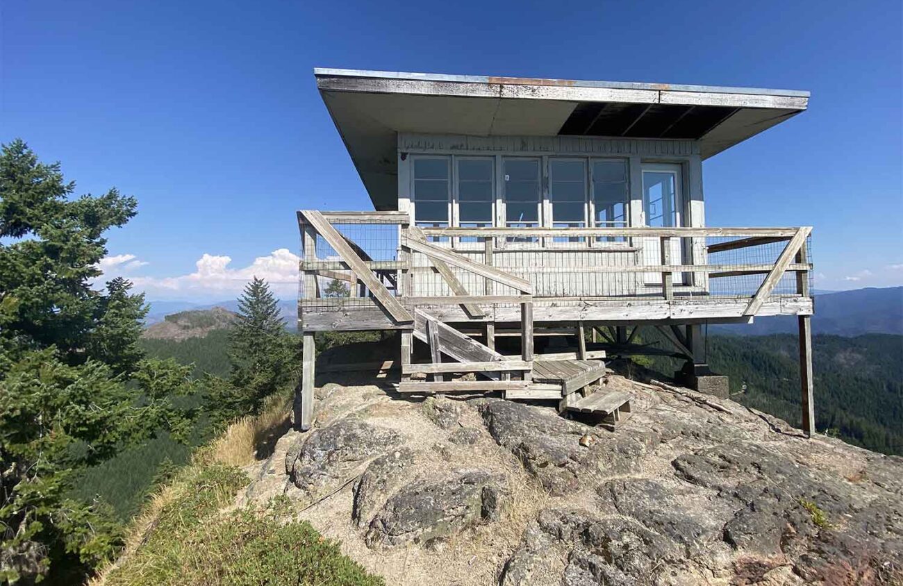
With so many trails limited by fire damage or permits, it’s time to revive a few forgotten paths. Here are two that are close to Eugene. The climb to Little Cowhorn Mountain’s historic lookout building gains 900 feet of elevation in 1.3 miles, passing lava pinnacles, wildflowers and lots of views. Nearby is the Tall Timber Trail, a 0.4-mile stroll to a grove of Douglas firs that are nearly 300 feet tall.
After decades without maintenance, both of these old trails were recently reopened by the Scorpion Trail Crew, part of the High Cascade Volunteers, in memory of that group’s founder, Ron Robinson.
The two trails are bright spots in the Fall Creek area southeast of Springfield. One of the most popular recreation destinations in the Willamette National Forest, the valley was hit by wildfires in 2003 and 2017, and by a devastating windstorm in 2019. The trails I’m recommending escaped all of those woes.
From I-5 just south of Eugene, turn east onto Willamette Hwy 58. After 14 miles turn left across Dexter Reservoir at a covered bridge. Follow the Jasper-Lowell Road 2.7 miles through the town of Lowell, where the road jogs left and then right. Just before another covered bridge, turn right on Big Fall Creek Road. Stick to this paved road for 10.5 miles, taking the larger fork at junctions. Beyond Dolly Varden Campground 0.4 miles, turn uphill to the left on Forest Road 1817.
Follow that gravel road for a total of 11.3 miles, keeping right at forks. Park when you reach a big triangular junction in a forested pass. If you have GPS in your car, the location here is 44.0375 -122.513.
Two small roads take off from the left side of this triangular junction. You want the uphill one to the right. It’s marked “388” and has a brown metal gate that may be open. It’s possible to walk this steep, rough road 0.5 miles to its end, where lookout staffers would park. It’s more fun, however, to hike the newly cleared trail. This path starts on the right, 20 feet before the “388” marker post.
The trail switchbacks 0.6 miles to the upper parking area. From there, head straight toward the mountain on a continuation of the trail another 0.7 miles. Rhododendrons grow 10 feet tall in old-growth woods. A dozen lava spires beside the trail are covered with gray-green lichen. Near the summit a cable handrail skirts a 100-foot cliff.
The 14-foot-square lookout building is empty and unused. Its leaky flat roof needs repair, but the windows are intact. A plank walkway around the cabin has views east to the Three Sisters. To the left, Mt. Jefferson is a tiny white cone above the clearcuts of private timberland that burned catastrophically in 2020. To the right, Diamond Peak rises above the less damaged Forest Service land of the Fall Creek Valley. Turkey vultures soar on drafts below the lookout.
The hike to Little Cowhorn only takes a couple of hours, so why not add a side trip to some of Oregon’s tallest trees? The Tall Timber Trail (aka the Tall Trees Trail) was built in the 1980s after rangers discovered the grove near the headwaters of Little Fall Creek. The Douglas firs here are six feet in diameter, which wouldn’t set a record, but their trunks rise like cathedral pillars. The lowest branches are often 160 feet in the air.
To find the Tall Timber Trail on your return from Little Cowhorn Mountain, drive back on Forest Road 1817 for 1.8 miles and turn right on Forest Road 1806. After 2.7 miles, when this road is blocked by a locked gate, turn left on a slightly brushy spur road for 0.4 mile to a parking area just before road’s end. The GPS location here is 44.0343 -122.5536.
The trail begins 50 feet before the parking area, angling up amid bracken fern and Oregon grape into the tall grove. After 0.3 miles the path switchbacks down into a creek glen where the route had been confused by fallen trees. The Scorpion Trail Crew left one log that you duck underneath, but they cut through the others — including a tree at the end of the trail that must have been one of the tallest in the grove. Now the giant log spans the creek canyon like an unrailed, 6-foot-wide bridge.
The trail ends a few feet beyond, at the rotting ruin of an old viewpoint deck. Instead, climb up onto the fallen tree, a more natural viewing platform, and a more appropriate conclusion to the Tall Timber Trail.
As fires and reduced maintenance budgets whittle away at our inventory of trails, the revival of forgotten paths has increasingly become the work of volunteers like Robinson, the trail crew founder who inspired the workers here.
William L. Sulllivan is the author of 23 books, including The Ship in the Woods and the updated 100 Hikes series for Oregon. Learn more at OregonHiking.com.

