You have to hike to see the ancient pictographs and historic fire lookouts of the North Umpqua. Prehistoric rock art is rare in western Oregon, where the rainy climate generally erodes the drawings.
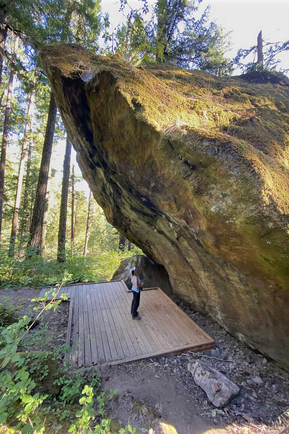
At Medicine Creek Rock Shelter, a tilted boulder has protected figures of people, spirits and a horse. A few miles away, a little-known trail up Illahee Rock leads to two of the oldest fire lookout buildings in the state. For a trip through history, hike to both in a day.
One way to protect such fragile places is to make them a little hard to visit. In this case you can expect a long drive.
To start, drive Interstate 5 to downtown Roseburg exit 124 and follow “Diamond Lake” signs through town. Then drive Highway 138 for 55 miles along the scenic North Umpqua River. At milepost 55 turn left onto Medicine Creek Road. Go straight to avoid a confusion of side roads near this turnoff. After 1.3 miles of gravel, park in a large pullout on the right signed “Medicine Creek Rock Shelter.”
The 0.2-mile path switchbacks up through an old-growth forest of 5-foot-diameter Douglas-firs, incense cedars and sugarpines. At trail’s end, beside a leaning house-sized boulder, a wooden deck discourages people from approaching the rock art too close — or, heaven forbid — touching anything.
You may have to squint to discern some of the red ochre and blue figures. The horse and rider on the left suggest that these pictographs can’t be older than the fifteenth century, when the Spanish introduced cavalry to the Americas.
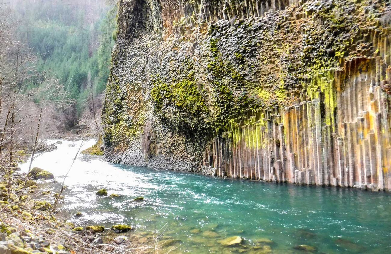
After examining the rock art, and before tackling the steeper 0.9-mile trail to Illahee Rock, why not stop for lunch? The picnic site I’m going to recommend has a spectacular riverside view of a columnar basalt cliff.
Drive back on Medicine Creek Road to Highway 138, but just before you reach the highway turn right on a gravel road, following a pointer for the Soda Springs Trailhead. After 1.3 miles, beyond a powerhouse and a trailhead, park at the Soda Springs Picnic Area on the left.
The spectacular basalt cliff on the far shore of the North Umpqua River is one of the many lava flows that have coursed down this valley from vents near Crater Lake. As the lava cools it cracks into columns perpendicular to the surface. Here the ground must have been uneven, because the columns splay like sausages.
After lunch at Soda Springs, it’s time to visit the two fire lookouts. The hike isn’t too difficult, gaining 550 feet of elevation in 0.9 miles. The drive, however, involves a long gravel road.
Return to Highway 138 and turn west back toward Roseburg for 8 miles. Near milepost 47, and 0.3 miles before the Dry Creek Store, turn south on gravel Illahee Road 4760.
Follow this one-lane road uphill, ignoring a spur to the right at the 1.4-mile mark for the Illahee Flats Trail. After a total of 7.8 miles you’ll reach a fork in a pass. Veer right on Road 100, a track that’s bumpy and a little brushy.
After 1.3 rough miles you’ll reach another junction. The trail to the lookout begins as steep, rocky Road 104 up to the left. This track is simply too rough to drive. So instead fork to the right a few hundred feet to park. Then walk back to Road 104 and hike it uphill 0.2 mile to the trailhead.
The 0.7-mile path that begins here is a delight, ascending a ridge full of rock gardens. A wildfire in 2017 burned this ridge very lightly, improving the views while reviving slopes of wildflowers and huckleberries.
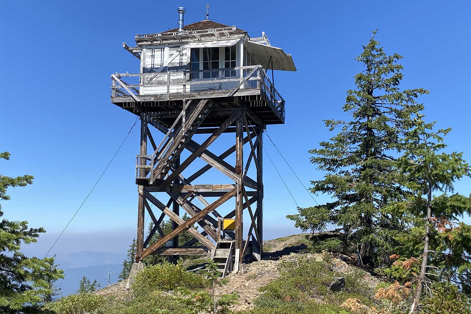
The summit has two lookouts — a towerless cupola-style building from 1925 and a “new” lookout from 1958 atop a 30-foot tower. If you climb its two rickety flights of stairs you’ll reach a locked trap door. Although a frustrated visitor has sawed a hole so it’s possible to squirm through, you probably shouldn’t.
The view is just as good from the ground. Look for pointy Mount Thielsen to the east, with snowy Mount Bailey and the rim of Crater Lake to the right.
Atop this lovely, lonely summit, it’s worth thinking about the tribespeople who trekked to such a remote part of the Old Cascades in search of “medicine” — the wisdom of the land’s spirits. Generations of lookout staffers must have drawn solace from that same source.
Today the trails to these historic sites are largely forgotten. How many of the people driving by on their way to Crater Lake hear the subtle call of the old spirits?
William L. Sullivan is the author of 23 books, including The Ship In The Woods and the updated 100 Hikes Series For Oregon. Learn more at OregonHiking.com.
