Do you love scenery and hate rules? McKenzie Pass is a gorgeous getaway, with views across lava fields to the Three Sisters. But most of the trailheads there now require advance permits. If you just show up at the Obsidian Trailhead a ranger is likely to send you home.
Don’t panic. Two of the best trailheads don’t require advance planning. I’m going to recommend easy hikes at Hand Lake and the Dee Wright Observatory. You’re not breaking the rules, you’re working around them.
The easiest trail of all is the most obvious. Simply drive to the summit of McKenzie Pass on Highway 242, park at the Dee Wright Observatory, and stroll the Lava River Trail. It’s a paved half-mile loop to views, weird lava formations, and remnants of a historic wagon route.
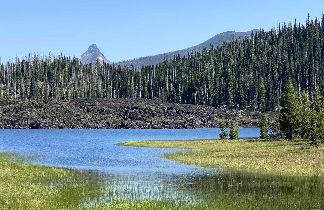
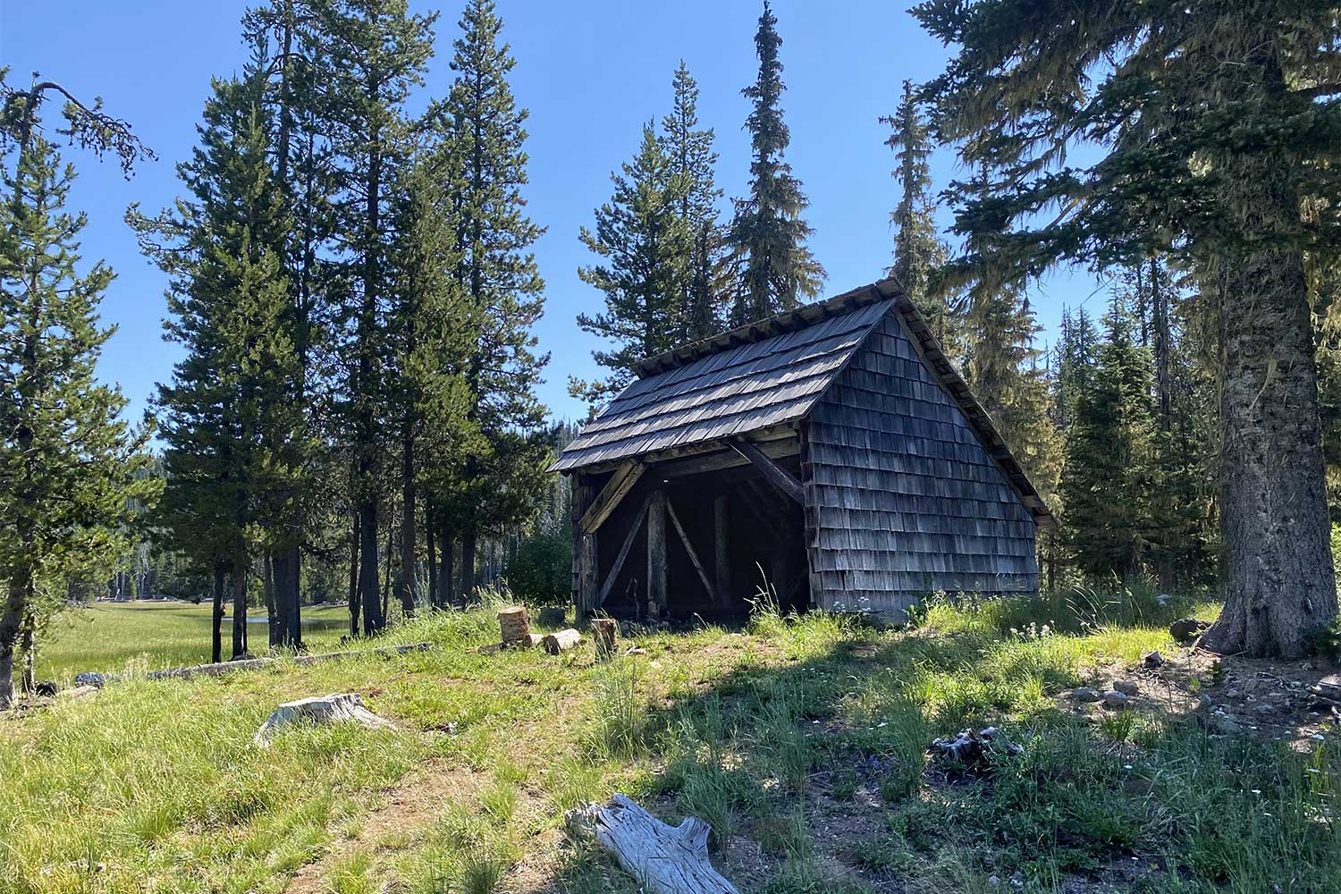
Is that too tame? Then hike through wilder woods to Hand Lake, where you’ll find a three-sided shelter, a great view, a meadowed lake, and an optional tour to another part of that same wagon route.
A little background: McKenzie Pass was a popular Native American route because it accessed obsidian that could be chipped to make arrowheads. Eugene pioneers converted the trail into road.
John Templeton Craig was one of 50 men hired by Captain Felix Scott to build a trail from Eugene over the Cascades in 1862. Scott took Craig and the rest of his roadbuilding crew up the McKenzie River valley, clearing a path for some 700 cattle, 60 oxen, and nine wagons.
When the road builders neared McKenzie Pass it became obvious that the biggest obstacles ahead were lava and snow. The lowest route through the mountains at McKenzie Pass crosses miles of jagged lava rockfields. Craig favored chipping out a road through the lava. But Scott said no. Instead, he headed a few miles south to a high notch he dubbed Scott Pass.
Because Scott’s route climbed a thousand feet higher on the shoulder of North Sister, it was steeper and crossed more snow. Craig vowed to return and open a lower route that crossed the lava fields. In 1871 Craig formed the McKenzie, Salt Springs and Deschutes Wagon Road Company. He laboriously chipped a roadbed out of the jagged lava.
Craig believed so strongly in his road that he carried mail across the route through 15-foot snow drifts in the winter. It was just after Christmas of 1877 when the 56-year-old Craig shouldered his mailbag and set out from McKenzie Bridge, alone and on skis, never to return.
Blizzards turned back a rescue effort six weeks later. A second search party discovered Craig’s frozen body wrapped in a quilt, on the cold ashes in the fireplace of his McKenzie Pass shack.
The current shelter at Hand Lake is not where Craig died, but it’s close, and it is a good place to hike a piece of his trail. To find the trailhead, drive Highway 242 to a small roadside pullout between mileposts 72 and 73. Marked with a brown hiker-symbol sign, the pullout is two miles past the Obsidian Trailhead and 4.5 miles before the Dee Wright Observatory atop McKenzie Pass.
You’ll have to fill out a free day-use permit here, but that’s the only red tape. Then set out on the Hand Lake Cutoff Trail through subalpine woods of mountain hemlock, lodgepole pine and red huckleberry. After half a mile you’ll reach the shelter. If you’re hiking with children, you might just let them romp to the lake and explore the meadow before heading back to your car.
For a longer loop to Craig’s wagon road, however, continue on the path directly across the meadow. Turn right at a signed junction in the woods.
After 0.4 miles the trail begins following the sandy edge of a lava flow. Continue up alongside the lava for 0.2 of a mile. Watch for a rock cairn marking the wagon road that cuts across the lava to the right.
The abandoned roadway is 15 feet wide, but it’s so old that a few struggling plants have had time to take root.
Follow the roadbed across the lava and turn right, following the sandy margin between the lava and the forest back down to Hand Lake. Though there is no trail here, the lake’s water level drops in summer, leaving a wide, hikable beach.
Go around the lake to the outlet, walk left along this creek until it narrows enough to be crossable, and then continue around the lake meadows to the shelter and the trail back to the car.
History, wildflowers, views — you get it all at Hand Lake. And you didn’t have to go online to Recreation.gov in the hopes of buying one of the permits required elsewhere at McKenzie Pass. Score one for rebels.
William L. Sullivan is the author of 24 books, including The Ship in the Ice and the updated 100 Hikes series for Oregon. Learn more at OregonHiking.com.
