Marion Lake was once the great escape from the Willamette Valley’s summer doldrums. But then half the Mount Jefferson Wilderness burned, and the other half seems to be open only to those who buy advance permits.
What to do? Try hiking the Pine Ridge Trail to Marion Mountain. This path mercifully escaped all the fires. Day hikers don’t need a special permit or even a parking pass.
An easy 2.2-mile stroll on the Pine Ridge Trail takes you to Temple Lake. Double the distance and you’ll reach the panoramic lookout site atop Marion Mountain. Altogether the route gains only 1,000 feet of elevation — not much for a mountain climb.
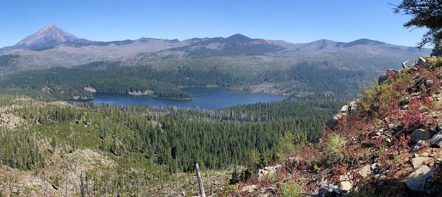
Ambitious hikers could descend 1.8 miles beyond the viewpoint to Marion Lake itself, but why? Marion Mountain has a view that the lake lacks, swiveling from the snowy pyramid of Mount Jefferson to the spire of Three Fingered Jack. Marion Lake lies at your feet, spread out like a map.
To start, drive up the McKenzie on Highway 126, continue east on Highway 20 toward Sisters for three miles, and turn left at the Santiam “Y” junction. Then follow Highway 22 toward Salem 11 miles to Twin Meadows Road on the right, where milepost 70 ought to be.
Twin Meadows Road is not wide, but it’s paved because it climbs five miles to Camp Pioneer, the Boy Scout camp at Pine Ridge Lake. The camp’s entrance is gated and closed to outsiders. Drive straight past it another tenth of a mile to a trailhead parking lot at the end of Twin Lakes Road 2257.
Large signs warn that overnight users must have bought advance permits before setting out on the Pine Ridge Trail. As a day user, you’re good to go. This is not really a good route for backpacking anyway. It’s a long way to Marion Lake, and there are only two campsites before then, at Temple Lake.
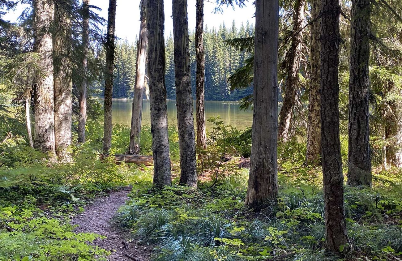
The trail sets off through a delightfully unburned forest of Douglas firs and mountain hemlocks with a carpet of vanilla leaf. In early summer clumps of beargrass put up big lilied plumes. By late summer huckleberry bushes offer blue fruit along the trail.
After just 0.2 miles you’ll reach an X-shaped junction with a wilderness registration box. The unmarked trail to the left leads a few hundred yards to Camp Pioneer. The faint Turpentine Trail to the right traverses viewless woods for five miles to the Duffy Lake Trail. Instead, go straight on the Pine Ridge Trail toward Temple Lake and Marion Mountain.
The Pine Ridge Trail is nearly level, crossing a few creeks that are usually dry. At the 1.9-mile mark, you’ll enter an open flat with a few sparse lodgepole pines — the first actual pines on the route. A large unmarked fork here gives you a choice. To the left, a spur trail descends 0.3 miles to Temple Lake, with a view of the top half of Mount Jefferson. The lake is only a few hundred yards across. The near shore is muddy and shallow, but if you bushwhack around to the left you’ll find water that’s deep enough for fishing or swimming.
Back at the main trail, continue 1.5 miles to a large trail junction. Turn right on the Marion Mountain Trail, climbing across slopes strewn with cinders from volcanic eruptions. After 0.8 miles the path switchbacks left up a ridge to Marion Mountain’s summit, a rock precipice surrounded by views. The Forest Service built a fire lookout cabin here in 1934, but that building hardly lasted 30 years atop this windswept peak.
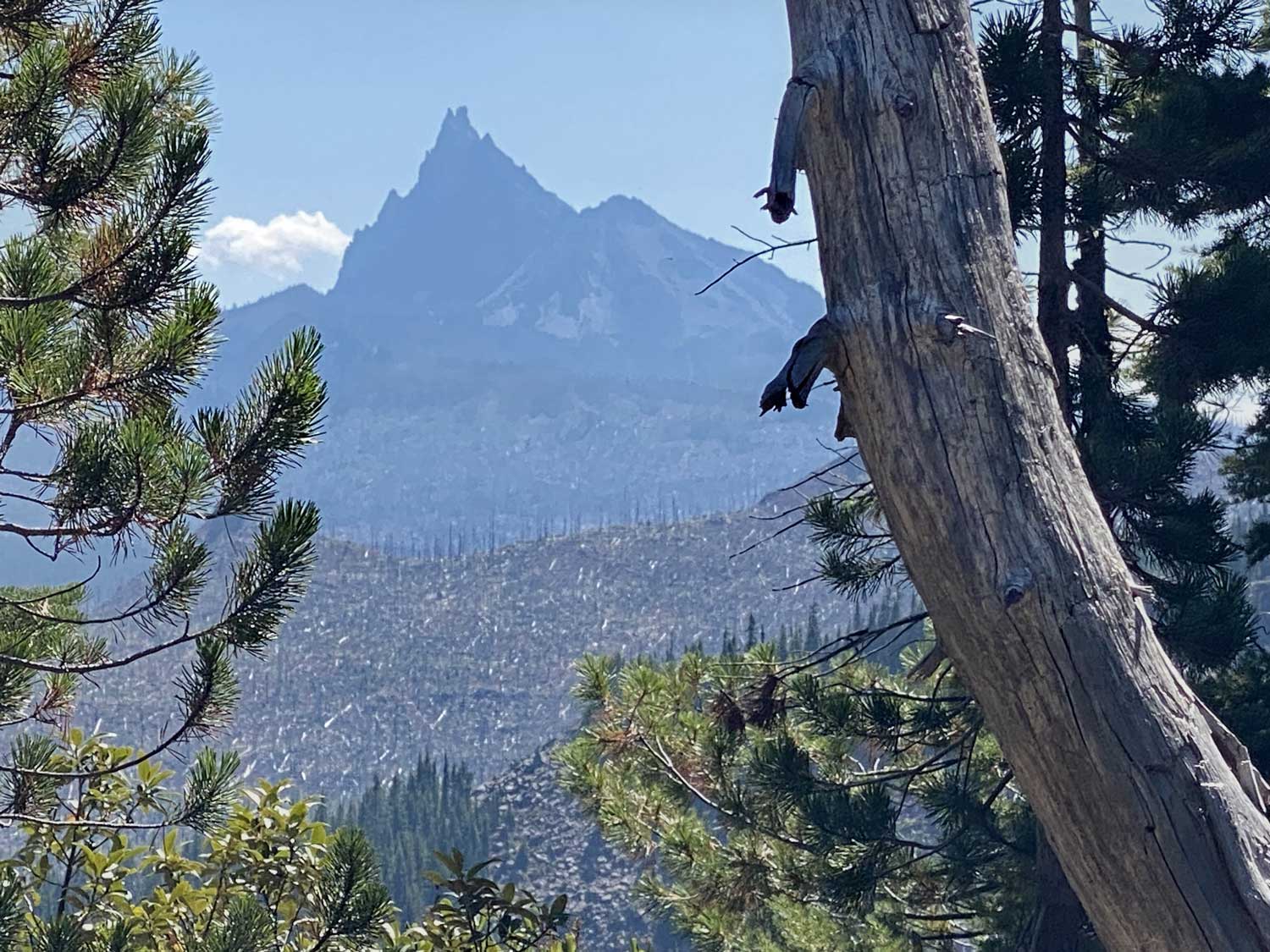
Mount Jefferson, Marion Lake and Three Fingered Jack are stars of the show, but the most remarkable part of the view from the old lookout site is the vast sweep of gray snags left by a 2003 wildfire. That blaze incinerated the once-popular Eight Lake Basin. The flames were evidently stymied by the cliffs of Marion Mountain, because this is where the fire stopped.
Visiting Marion Lake itself from this viewpoint would require a long side trip, losing lots of elevation that would later have to be regained. Of course, there is a simpler way to see Marion Lake. An easy 2.3-mile trail from Marion Creek Road will take you there — if you are lucky enough to get a permit.
For years, Marion Lake was so overused by Oregonians seeking respite from the Willamette Valley’s summer heat that the shore was trammeled bare. The Forest Service’s permit system has succeeded in limiting the crowds and restoring the lakeshore.
Marion Lake is now harder to visit. But you can look at it for free by hiking the Pine Ridge Trail.
William L. Sullivan is the author of 24 books, including “The Ship in the Ice” and the updated “100 Hikes” series for Oregon. Learn more at OregonHiking.com .
