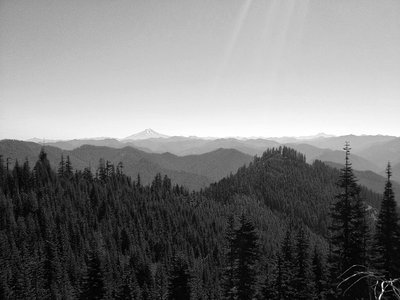
Crabtree Lake lies high in a glacial cirque in the Old Cascades among ancient and massive old-growth Douglas fir.
The hike into Crabtree Valley starts high above at the end of an old forest road that has been blocked by large rocks. As you walk along this abandoned road there are outstanding views of Mount Jefferson to the east. At .3 mile you will cross over another old road and begin the decent towards Crabtree Lake; the trail will veer north at this point. While descending be sure to frequently look towards the west to see both Crabtree Lake and a small marsh to its north. Your best view of the valley will come at .5 mile.
Near 1.6 miles you will come to the first set of concrete barricades; at this point you will sharply turn north (left) and continue towards Crabtree Lake. At 1.7 miles in you will come to another set of concrete barricades and here you continue north. Less than 100 yards after the second set of barricades there will be a trail to the left; this will take you to the marshy lower lake.
To continue onto Crabtree Lake stay on the main trail for less than .1 mile. There are two small campsites near the shore of Crabtree Lake that make this a worthy destination for a short overnight trip. After the relatively exposed hike to Crabtree Lake, swimming (in summer) is an excellent way to cool off in the warm water.
Crabtree Valley’s north-facing slope and moist bottomlands spared it from fire for a long period of time, allowing absolutely massive Douglas fir and Western hemlock to thrive. This area is an outstanding example of what much of the Old Cascades looked like before industrial logging turned it into tree farms. Crabtree Valley has nearly been clearcut many times, but after being transferred from Willamette Industries to the BLM there is hope it will not be logged.
Hike stats. Directions from Sweet Home: Follow Highway 20 for 6 miles, turn left onto Quartzville Road and travel 20.5 miles. Turn left onto paved 11-3E-35.3. Follow for 1.2 miles, turn right onto 11-3E-35.1. Follow this paved road for 3 miles until you reach a “Y,” turn left onto a gravel road, follow this road for .9 mile until you reach the trailhead. Hike distance: 3.8 miles; hike type: out and back; elevation gain: 1,000 feet; highest elevation: 4,100 feet; trailhead elevation: 3,900 feet.