It seems like magic: The Metolius River emerges fully grown at 50,000 gallons a minute from the base of an old volcano in Central Oregon. Sample the river’s wizardry with either of two easy hikes along the oasis-like riverbank. The walks visit a fish hatchery and pass sudden springs.
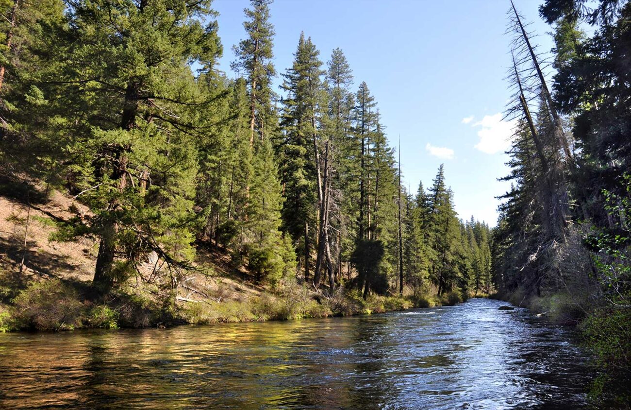
Even at its source at Black Butte, the river is 60 feet wide, deep right to the edge, racing along at a white-capped 10 miles per hour. How could a pile of cinders like Black Butte be producing so much water, winter and summer, without variation, at a constant temperature of precisely 46 degrees Fahrenheit?
It turns out the butte is not creating the river, not even by magic. Instead, the volcano has been trying to destroy the river for several thousand years, by erupting right on top of its traditional channel. Since then lava from Mount Washington has covered up all trace of the poor river’s ancient headwaters.
The Metolius River was beheaded, and then buried. But the river refuses to die. The melting snows of the eastern slope of the Cascades go underground instead, slowly percolating through the lava until the water finds its old riverbed at the Head of the Metolius. There the river emerges victoriously and splashes on as ever.
Start your visit by driving Highway 20 east of Santiam Pass 10 miles (or west of Sisters nine miles). Just west of Black Butte, near milepost 91, turn north at a sign for the Metolius River and Camp Sherman. After 2.5 miles, fork to the right on Forest Road 14 at a “campgrounds” pointer. Follow this paved road another 1.5 miles to a parking area for the “Head of the Metolius” on the left.
A paved 0.2-mile path leads to a viewpoint of the river’s source and snowy Mount Jefferson. But the walk here is simply too short to count as a hike.
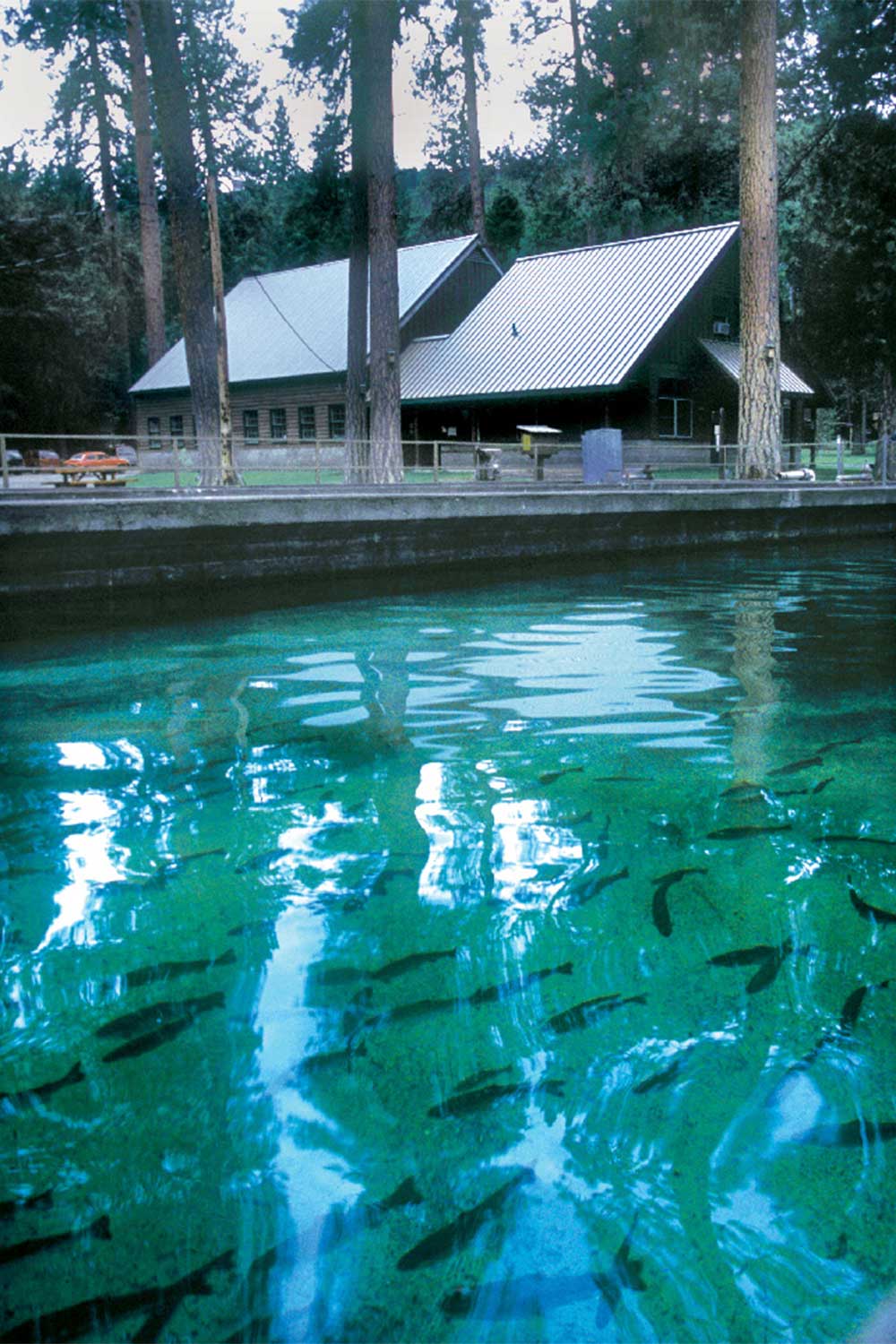
To see more Metolius, get back in your car and continue on paved Forest Road 14 for another 5.9 miles. At a “hatchery” sign, turn left and go for 0.3 miles and cross a bridge over the Metolius River to the road’s end at the Wizard Falls Fish Hatchery.
Walkways lead past a restroom building into the hatchery’s grounds, where rustic 1947-vintage buildings and concrete fish pools are set amidst tidy green lawns and towering ponderosa pines. Although there are no formal tours, friendly staff members always seem to be on hand to answer questions. Fish food can be purchased from dispensing machines for 25 cents. Those quarters eventually add up to a fair amount of change, which the staff uses for charity.
Wizard Falls itself is not really a waterfall, but rather a bubbly blue rapids over a lava ledge on the upstream side of the road bridge.
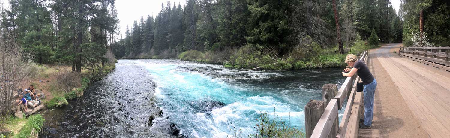
The recommended hike from this starting point is an out-and-back walk upstream 2.7 miles that passes river islands and a gushing spring. Starting at the hatchery’s restroom building, cross the road (but not the river) to a trail with a “fly fishing only” sign.
After walking half a mile upstream on the West Metolius Trail you’ll notice that the river’s whitewater splits around a series of long islands. Sprouting here are great bushes of monkeyflower and giant-leaved hellebore.
Birds delight in these islands. Look for broods of goslings paddling about, bright yellow tanagers hopping in streamside shrubs, and the peculiar robin-sized water ouzels that whir along the river’s surface, at times diving to “fly” underwater.
Spectacular springs enter the river from the far bank at the 2.3-mile mark, gushing like a dozen opened fire hydrants. Is this more Metolius magic? Not really. The water in this gigantic spring is merely taking a shortcut underground from a riverbend just upstream.
Beyond the gushing spring, the river turns to the right, winding through a steep canyon with old-growth ponderosa pine trees. Just 0.3 miles beyond the springs you’ll reach the trail’s end at Lower Canyon Creek Campground, where Canyon Creek joins the Metolius.
At this point you’ll have to retrace your steps 2.7 miles back to your car at the fish hatchery, but here’s the real magic: The Metolius is so charming that it’s a joy to hike it twice.
William L. Sullivan is the author of 27 books, including The Ship in the Ice and the updated 100 Hikes series for Oregon. Learn more at OregonHiking.com.
Help keep truly independent
local news alive!
As the year wraps up, we’re reminded — again — that independent local news doesn’t just magically appear. It exists because this community insists on having a watchdog, a megaphone and occasionally a thorn in someone’s side.
Over the past two years, you helped us regroup and get back to doing what we do best: reporting with heart, backbone, and zero corporate nonsense.
If you want to keep Eugene Weekly free and fearless… this is the moment.