Hendricks Park is Eugene’s first and oldest city park — 78 acres of hiking trails, flower gardens and open space provide a wooded escape from the hustle of the urban center. A steep drive separates the Fairmount and Laurel Hill Valley neighborhoods from the rest of Eugene, but the historic homes interspersed with modern designs offer a picturesque view of the city.
Coveted land around the park has been sparsely developed, and a proposed Planned Unit Development (PUD) in the Capital Hill neighborhood behind Hendricks Park could have ramifications such as increased traffic, noise and landslides.
Facts are being called into question on a Trumpian scale as opponents and supporters of the project have spent years hiring professionals to establish the credibility of their arguments.
Opponents assert that safety for the neighborhood and the crown jewel of Eugene’s park system hang in the balance. PUDs allow developers to meet density and land-use goals without having to adhere to strict zoning rules, affording flexibility and opening the door for setting new precedents.
A hearing is scheduled for Wednesday, March 7, to determine the future of the Capital Hill PUD.
Meet the Neighbors
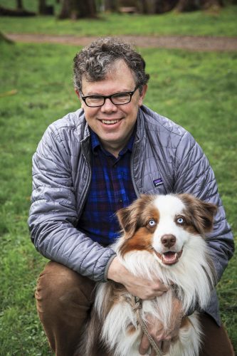
When he started planning his development in 2013, Tom Dreyer, a retired plastic surgeon living in the neighborhood, dreamed of a small project that had wide-reaching impact — a “viable neighborhood.” Dreyer says he bought the property to prevent someone else from developing it at maximum density.
Only one of Dreyer’s plans has been submitted to the city as a formal proposal. He says he wanted input from his neighbors, but they have resisted his plans.
The Capital Hill neighborhood and proposed PUD is nested in the East Hills of Eugene. Signs decrying the safety of the Capital Hill PUD dot the winding road leading to the top of Capital Drive and the “Pink House” where Dreyer lives.
Neighbors are concerned about traffic safety: Capital Drive is a steep, winding road with sharp curves and blind corners. Residents and visitors are allowed to park on the road, creating safety hazards.
Jason Brown, a leader of the Fairmount Neighborhood response committee combatting Dreyer’s proposal, says the original plan for five large units was generally accepted. The final plan — the one officially submitted for review — includes 34 lots.
“Almost everyone was okay with five lots,” Brown says, but as the number continued to grow, concerns about safety and the health of Hendricks Park and the neighborhood interfered with Dreyer’s plan.
The response committee, Brown says, isn’t interested in restricting Dreyer’s property rights or his right to develop.
“The Oregon way is not to be confrontational,” Brown says. “People see this vote against it as confrontational with the applicant, but I’m trying to explain that this is how the process works. You have to just reject what’s on the table. That’s not rejecting his right to develop, just the version he is proposing.”
Dreyer contends that he has been “very generous” in terms of the size of the conservation easement — land where trees will be preserved — and the density at which he is building, which is somewhere between 2.6 and 2.9 units per acre.
Dreyer says he is allowed to develop five units per acre; instead, he is choosing to develop at nearly half that.
Understand the Laws
Brown says Dreyer is using some “Donald Trump facts” — meaning they’re only half-true. Brown explains that while R1 zoning (residential zoning) allows for the development of five units per acre, the private land Dreyer has purchased is only partly in the R1 zone. The situation is complicated by a 1970s study that has been adopted into city code that protects the land.
The South Hills Study recognized the hills surrounding Eugene as an important feature of the city. “That ‘evergreen edge’ is actually protected by the zoning,” Brown says. “So one of our objections is that if the PUD is passed, the entire hilltop will be open to a clearcut.”
The study addresses characteristics of trees that should be preserved by developers. Dreyer’s assessment fails the requirements of the code because he hired a landscape architect instead of a certified arborist to evaluate the trees, Brown says.
The response committee hired its own arborist, James Mehrwein, who said the trees the PUD proposal classified as “fair or poor” condition actually “appear to be healthy, quite normal,” according to Brown.
Clearcutting and toothless agreements are concerns for opponents of the PUD. Dreyer has placed a third of the trees on the PUD land in a “do not touch” area, he says. Opponents say these are non-binding words and sentiments.
Any binding covenant would have to be established by the revamped homeowners association for the neighborhood Dreyer is hoping to build. Brown says only the covenants and restrictions written by such associations are enforceable when it comes to protecting designated land.
The covenants and restrictions, however, haven’t been submitted — they will be submitted after the application is approved. “At which point they can do whatever they want,” Brown says.
In April 2017 the city fined Dreyer $4,320 for removing a small stand of trees without a permit in the vacant lot he owned across from his home, documents show.
“This is the kind of person we are dealing with,” Brown says. “This isn’t just character sniping. The PUD application is asking the community to trust that he will do certain things, because it’s not in fact proposing to build them into the application in any kind of legal way.”
Dreyer says that Brown and other neighbors are producing “Donald Trump facts” of their own. He explained that his development is small enough not to require a traffic study, but he conducted studies anyway, “showing the roads are perfectly adequate” to handle more traffic.
Branch Engineering conducted two traffic surveys for Dreyer. The first report was “built on the premise of more units,” Carol Schirmer, Dreyer’s landscape architect, said in an email to EW. “The revision [the one received by EW] was based on less units which, of course, concluded that there were no safety issues created by the development because there were less units than report 1.”
The study evaluated three different sections of Capital Drive in order to determine current traffic levels and speeds. Tube counters — industry standard cameras used to measure traffic — were set up on Capital Drive in strategic areas.
Collected data showed that the development would add “roughly 141 daily trips, assuming full occupancy of the 31 new dwelling units.”
Engineers requested crash data from the Oregon Department of Transportation for the section of Capital Drive between Spring Boulevard and Hendricks Park. The most recent five-year period data they received — Jan. 1, 2010 to Dec. 31, 2014 — did not include any crashes.
A reporting form only has to be filed with the DMV if damage in a crash exceeds $1,500 or there is an injury or fatality.
Encroaching on the Park
Noise and traffic in the neighborhood may affect visitors in the park as well. Dreyer has established a buffer zone between his development and the ribbon trail, but hikers value the solace the forest provides.
“The forest offers trails, hiking in the middle of the city, hiking through the woods,” says Sandra Austin, a founding member of Friends of Hendricks Park.
Austin was asked by PUD opponents to have the board write a letter opposing Dreyer’s project. She said she would take the idea to the board, but Friends wasn’t ready to take a side.
“We aren’t opposed to taking a stand, but we are waiting,” says Jim Beyer, another longtime member of Friends. Beyer says the continued expanding of the development doesn’t sit well with Friends, and the potential visual impact is even more concerning.
“The ribbon trail that goes from Hendricks Park to 30th Avenue is a sweet little trail. And for the most part, you have no idea that there’s anyone around,” he says. “If you had a whole hillside up there, that would take some of the sweetness of that particular thing away.”
If the proposed PUD is approved, the park is at risk of more than just being an eyesore.
When trees grow in stands they protect one another from windthrow. As stands are thinned, large trees left behind — such as those in the buffer zone — are more susceptible to being toppled, as their roots haven’t developed the strength to stand on their own in high winds.
“Harvesting the designated trees will significantly increase the risk of wind damage to the remaining trees,” Mehrwein said in the letter from Brown to the city. “Trees not only on the CHPUD site, but also in adjacent private properties and in Hendricks Park would be vulnerable to being blown down or having tops broken.”
Trees on private land contained in the PUD are vital to the stability of the eastern ridge of the park. Brown cites Mehrwein in his letter, writing that those potentially toppled trees in the PUD “significantly contribute to the risk of catastrophic landslide.”
Whether it’s trees above the park falling down and sliding into trails, or trees in the park that are no longer protected, critics argue that miscalculations by planners could have far reaching effects on the cherished land.
On one hand, Dreyer says he is looking to improve his own neighborhood. On the other, he says he is looking out for the best interests of the city.
“Eugene has a real and desperate need for housing,” Dreyer says. “I’m a big advocate of the urban growth boundary. It prevents sprawl and keeps neighborhoods more compact.”
The trouble with the boundary, however, is that once filled in, there aren’t enough places to build, unless in-fill projects such as Dreyer’s are allowed, he says.
State law requires cities to keep a 20-year inventory of developable residential land. For years, Eugene has classified the in-fill pockets in the south hills as such, Dreyer says.
“But people have had trouble developing it,” he adds. “If the city doesn’t allow development in those areas, then they don’t have their 20-year inventory and at some point the state will say, ‘You’ve got to do something.’”
Dreyer says he fears that “something” will mean expanding the urban growth boundary and contributing to sprawl along riparian areas and the rivers.
Opponents to the development acknowledge the difficulties of their position. They don’t want to propose what happens to the land, but they don’t want to see it developed according to this proposal.
Brown would like to see the land donated to the park but worries about crossing the line between being a neighbor concerned about the legality of the proposal and an activist converting private property into public land.
As a group however, opponents have made a concerted effort to raise money and buy the land from Dreyer rather than see it developed and harm the park.
“If it weren’t for the park system, I just wouldn’t care,” Brown says. “I’m certain that 30 years from now, people will say, ‘Why was that allowed to happen?’”■
The public hearing will take place on Wednesday, March 7 at 5:30 p.m. at Harris Hall, 125 E. 8th Ave. Both the developer and response committee will offer final arguments for their cases. The meeting is open to the public.