You’ve probably heard that the Waldo Lake area burned last fall. The Cedar Creek Fire smoldered through August, but then ripped around the shore of the beautiful High Cascades lake in September and October. What’s left?
You could still camp at Shadow Bay, the only campground that survived, but good luck getting a site. Instead, why not visit The Twins or Bobby Lake? And yes, most of the mosquitoes are now gone.
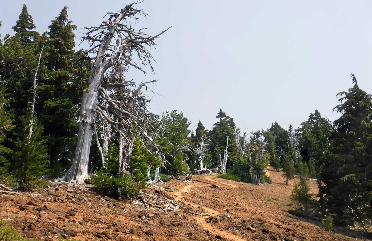
Before I tell you about the open trails, let’s pause a moment to honor the ones that burned. From Shadow Bay it is still possible to walk 1.7 miles to the South Waldo Shelter, but everything beyond that is black, right down to the lakeshore. Lillian Falls couldn’t burn, but its trail and access road did. The Forest Service managed to wrap the Waldo Mountain lookout in fire-proof Kevlar, but everything else in that area burned except the meadows and the lakes. The north shore of Waldo Lake had been slowly recovering from a 1996 fire. It burned again.
Don’t give up! For a backpack that’s suitable even for kids, hike 2.2 nearly level miles east of Waldo Lake through an unburned mountain hemlock forest to Bobby Lake. For a better view, a 6.6-mile loop with 1,600 feet of elevation takes you to The Twins, cinder cones that overlook the entire Waldo Lake area.
To start, drive Willamette Highway 58 east past Oakridge to milepost 59 (three miles before Willamette Pass). At a “Waldo Lake” pointer turn left onto paved, two-lane Forest Road 5897. For the easy Bobby Lake hike, drive this road 5.4 miles and park in a huge pullout for the Betty Lake Trail on the left. Then walk across the road to the Bobby Lake Trail, where there isn’t much parking.
The trail to Bobby Lake is part of the planned Eugene-To-Pacific-Crest-Trail, a 74-mile route that still has gaps elsewhere.
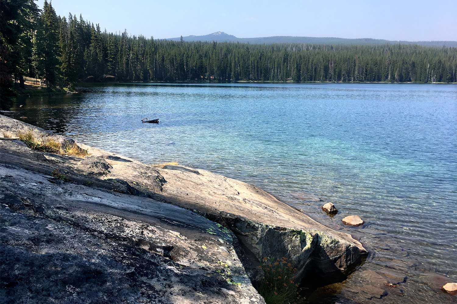
After hiking 0.3 miles toward Bobby Lake, ignore side trails to the left and right. Go straight another 1.8 miles, cross the Pacific Crest Trail, and continue 0.2 miles to Bobby Lake. There are lots of campsites here, but the brushy shore has no beach. So hike to the right around the lake 0.2 miles to an enormous outcrop of glaciated andesite — the perfect swimming rock on a warm summer day. The polished bedrock slopes into a sandy wading area next to the deepest part of the lake.
If you’d prefer a tougher hike with better views, head instead to The Twins, cinder cones with summits on either side of a crater. To find the trailhead, drive paved Forest Road 5897 north past the Bobby Lake Trailhead another 0.7 miles (a total of 6.1 miles from Hwy 58), and pull into a dirt parking loop at a sign for the “Twin Peaks Trail” on the right.
The trail to The Twins climbs gradually at first through a dry forest of lodgepole pine, mountain hemlock and red huckleberry bushes. After 1.6 miles, cross the Pacific Crest Trail and begin climbing more steeply. Watch for hemlock trunks that zigzag, forever locked in deep knee-bends by winter snows. Snow can be 12 feet deep here, judging from the gray-green Alectoria lichen that beards trees only above that height.
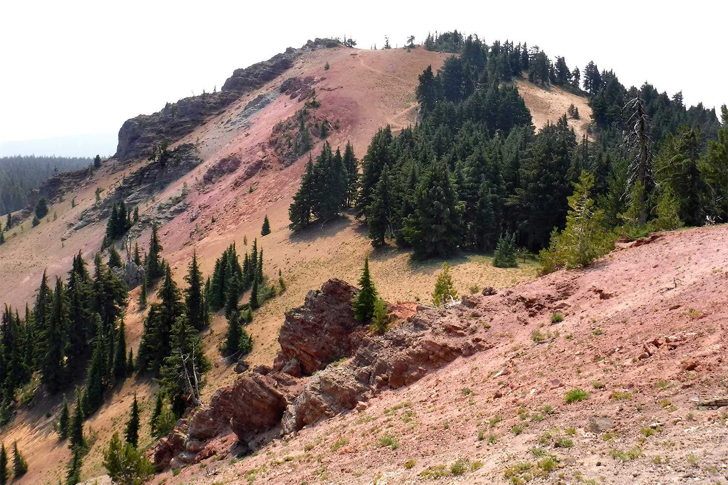
Beyond the PCT 1.2 miles, note a side trail signed “To Charlton Lake” on the right. This is the return route of a loop around the summit. For now, continue straight. As the trail climbs steeply up the red cinders of the crater you’ll get your first view south to Diamond Peak. Follow the trail along the rim amid wind-gnarled whitebark pines to the highest point of the North Twin. The view here includes the distant Three Sisters above the burned woods at Charlton Lake.
To continue on a loop, keep right on a trail that descends 0.1 miles to a fork in a pass. A short spur to the right climbs 200 feet to the top of South Twin, a higher peak with lesser views. For the loop, veer downhill to the left at the pass onto a rougher, unofficial trail that descends 0.3 miles to the Charlton Lake Trail, in another pass. Turn right on this trail for 0.5 miles to circle the base of North Twin to the main trail. Then turn left to return to your car.
Or are you not yet ready to return to your car? For a longer loop on your way back from The Twins, turn left on the Pacific Crest Trail for 2.5 miles to the Bobby Lake junction. The lake is to the left. For the loop, turn right for 1.8 miles, and then turn right again on a 1-mile connector trail back to the Twin Peaks Trailhead.
Not all of Waldo is lost!
William L. Sullivan is the author of 23 books, including The Ship in the Woods and the updated 100 Hikes series for Oregon. Learn more at OregonHiking.com.
