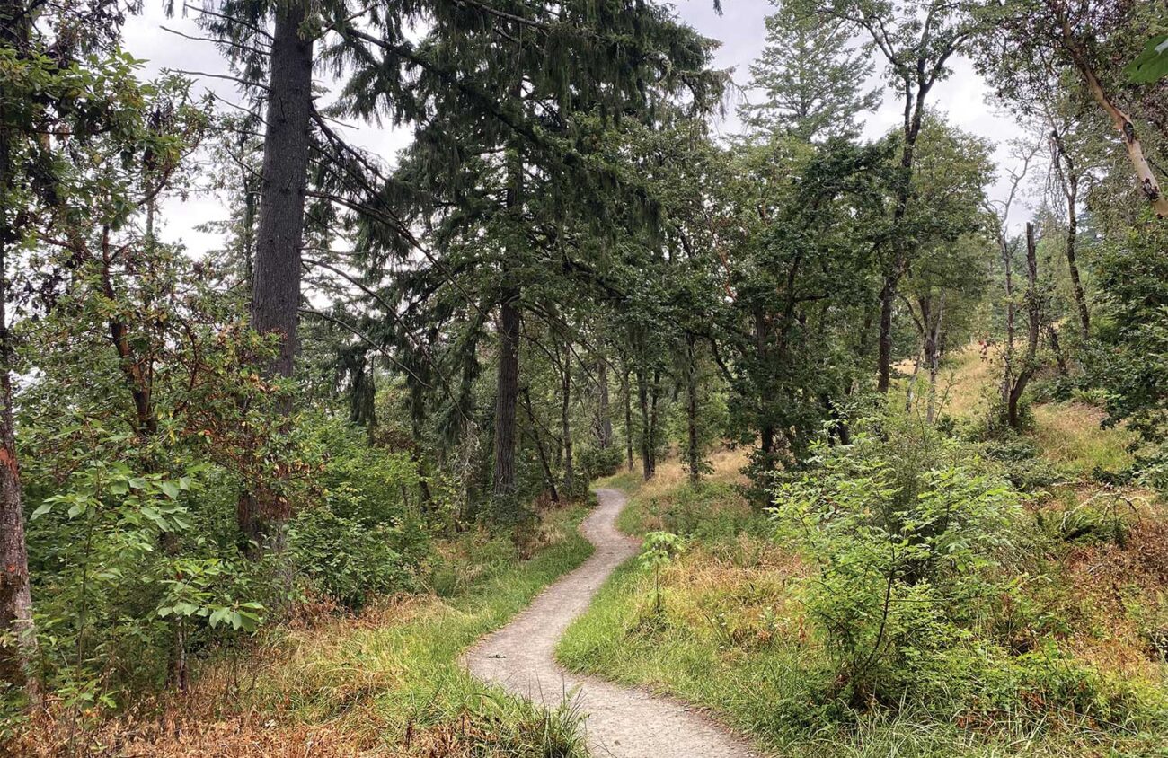
Wild irises bloom in summer on this ridge overlooking west Eugene. The wide gravel path climbs through meadows, partly beneath a powerline, to a water tower shaped like an alien mushroom, and then returns through quiet woods.
Wild Iris Ridge is a lovely, easy hike in fall. But could it also be a link in the long-sought dream of a Ridgeline Trail circling the city?
Other Oregon cities have had this dream as well. In 1905, Portland hired Frederick Law Olmsted, the landscape architect who designed New York’s Central Park, to develop a recreation plan. He proposed a “40-Mile Loop,” a hiking trail that circled Portland. Today, the spectacular 30-mile Wildwood Trail through Portland’s Forest Park remains from that dream, but much of the rest is missing.
In 2012, Bend voters authorized $29 million for a Deschutes River Trail traversing the city from Tumalo State Park to Sunriver. Money ran out in 2017 with a few gaps left, but the vision remains
Eugene’s Ridgeline Trail began with the popular trail from a Willamette Street parking lot up Spencer Butte. The path later extended east across Fox Hollow and Dillard roads to Mount Baldy. Another section went west to the TV towers atop Blanton Heights. Meanwhile bike paths along the Willamette River and Amazon Creek suggest a northern portion of a city-circling path. What’s missing?
The city of Eugene says it’s in the business of building sidewalks, not trails. The city’s built only one mile of trail in the past 20 years. Instead, the city has entrusted a private nonprofit organization, the Eugene Parks Foundation, to come up with answers. The EPF’s director, Ariel Lissman, has taken the bull by the horns.
Already the EPF is planning a network of trails in South Eugene Meadows, adding a new route from Blanton Heights to Willamette Street. Lissman is on the hunt for the final $150,000 needed to match a donor’s initial $250,000 challenge for that project.
But Lissman wants more. He’s helped the EPF raise $250,000 to build a park and trailhead across the street from the Wild Iris Ridge Trailhead. From there a boardwalk across Natural Conservancy land in the Willow Creek wetlands would connect Wild Iris Ridge to the Amazon bike path — and from there, the Willamette River.
Lissman wants still more. He envisions building the Ridgeline Trail east from Mount Baldy, through Suzanne Arlie Park to Lane Community College. From there, a path through an old tunnel beneath the railroad tracks would connect the Ridgeline Trail to the Willamette River.
All that would be left for a city-circling path would be a 1-mile gap of private land between Wild Iris Ridge and Blanton Heights. Lissman keeps calling the Sause Brothers, the owners of that property. What will it take, he wonders, to make them answer the phone?
Why not hike up Wild Iris Ridge to see this interesting gap for yourself? A 3.7-mile loop to the weird water tower atop the ridge gains just 650 feet of elevation. It’s easy enough for hikers with kids or dogs. It’s open to mountain bikers, too.
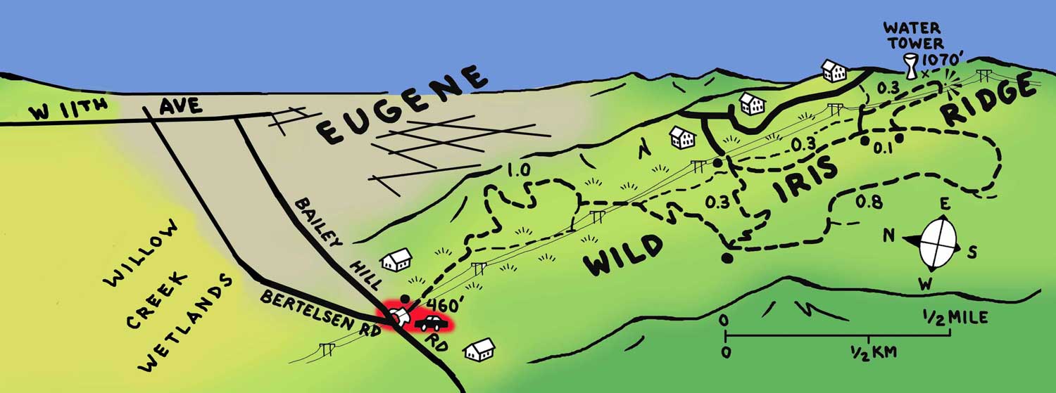
To find the trailhead from downtown Eugene, head west on 11th Avenue for 2.9 miles. At a light just beyond Fred Meyer, turn left on Bailey Hill Road for 1.6 miles. The trailhead parking area is on the left, at the junction with Bertelsen Road.
The trail starts as a service road beneath powerlines, but after 0.2 miles you turn left on a friendlier path. This trail climbs through woods and meadows, crossing under the powerlines again. At the 1-mile mark you’ll reach a junction at the start of the loop. Head left for 0.3 miles. Just before a city street, turn right on an old road converted to a trail. You could follow this road/trail on a 1.1-mile circuit to complete the loop.
If you want to see the weird water tower at the ridge’s highest point, however, follow the road/trail just 0.3 miles to a junction. Turn left here on a side trail that takes you to another city street. Just before the street you can turn right on a public path underneath the powerlines. This trail passes the alien mushroom of a water tower, as well as a viewpoint of the Ridgeline Trail gap. Then the path curves back down to the loop road/trail, where you turn right for the 1.8-mile walk back to the trailhead.
Eugene has dreamed big before — building a university, riverside bike paths, and a spectacular downtown library. Hike the Wild Iris Ridge trail to dream a little bit more. Imagine a 40-mile trail that circles the city, connecting the southern skyline with the Willamette River. That’s the Eugene spirit.
William L. Sullivan is the author of 23 books, including The Ship In The Woods and the updated 100 Hikes Series For Oregon. Learn more at oregonhiking.com.
