If you’re looking for a hike at the Oregon Coast, but don’t want to tramp the crowded trail to the Heceta Head lighthouse yet again, why not mix things up by starting at the quietest beach access in Lane County?
That would be the Muriel O. Ponsler Memorial Wayside — a picnic area with a fancy stone entryway that everyone sees as they zoom past on Highway 101, although no one ever seems to stop. The beach here will be all yours, in part because the scenic little wayside has no restroom and no water. There are just 10 parking spots, a few tables and the beach.
The hike from Ponsler to the lighthouse is 3.6 miles each way. Yes, there are shorter routes to the tip of Heceta Head. The easiest, most crowded trail is only half a mile. But then you would have to pay $5 to park at the former Devils Churn State Park — a place Salem bureaucrats rechristened “Heceta Head Lighthouse State Scenic Viewpoint” as part of an effort to remove satanic references from state park names. I only take that route with out-of-state guests who expect to see Oregon in a single day.
Another possible route to the lighthouse is 1.3 miles. It starts at a small, poorly marked pullout on the shoulder of Hwy 101, one mile north of the lighthouse viewpoint. Parking is free, but there’s seldom enough room.
What I like about the Ponsler route to the lighthouse is that it’s long enough to fill half the day, justifying a drive to the coast. It’s also got variety, with the first two miles on a quiet beach and the next 1.6 miles on a trail through the woods.
To start, drive south of Heceta Head 3 miles to milepost 175 and turn left into the Ponsler Wayside.
From the picnic area, hike to the beach past a big fluorescent green “90” sign — a search and rescue marker indicating that this is the 90th beach access south of the Columbia River. Then you hop across China Creek, which meanders over the beach amid cobbles, logs and sand. It can be windy here.
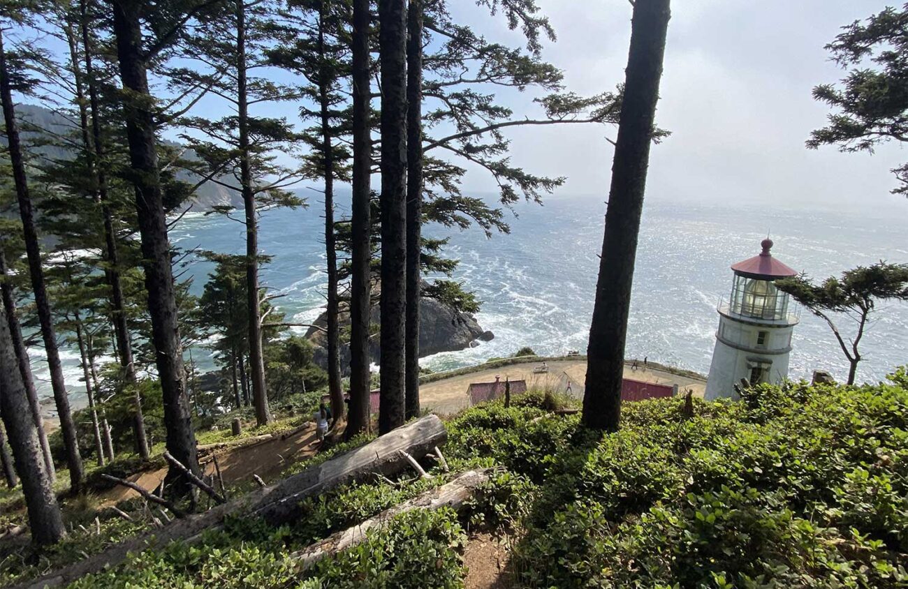
Head south on the wide, flat beach toward the pale green outline of Heceta Head, almost always wreathed in fog. Except at the highest tides, the sand is hard — which is to say, it’s easy to walk on.
Sandpiper-sized sanderlings run ahead of you, pecking for bugs, and then whirl away in formation. Depending on what the last storm washed in you’ll see sand dollars, crab shells, jellyfish, celery-shaped sea palms or whip-shaped kelp.
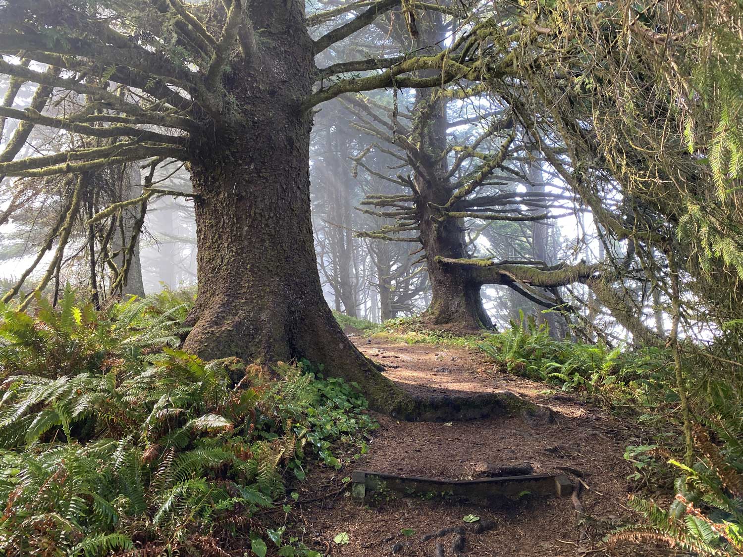
After 2 miles — and just 0.2 miles before the beach ends at the headland — look for a fluorescent green “93” sign that marks the Hobbit Trail up into the woods to the left. This path won its name because it resembles the round entrance to one of J.R.R. Tolkien’s fictional hobbit holes, tunneling up amid storm-bent shore pines, evergreen huckleberry, salal and rhododendrons.
After 0.3 miles, at a big trail junction just before the crowded Hwy 101 parking area I described earlier, turn right on the 1.3-mile portion of the Oregon Coast Trail to Heceta Head.
Now you traverse big spruce woods, with occasional views down to wave-churned coves. Fog whips up from the sea here even on the sunniest days, dripping from the trees like rain. As a result, licorice ferns are able to grow on the wind-bent spruce branches. What a jungle!
On this section I met two young red-headed boys. The older one said, “My brother and I are having a debate. Are we in the clouds?”
“It’s fog,” I said.
“Ha!” The older boy pointed triumphantly at his brother.
I explained, “Fog is a cloud that’s on the ground.”
Now it was the younger boy’s turn to point at his brother and gloat. “Ha!”
The trail has lots of ups and downs, often with staircases. Finally it switchbacks down to the lighthouse.
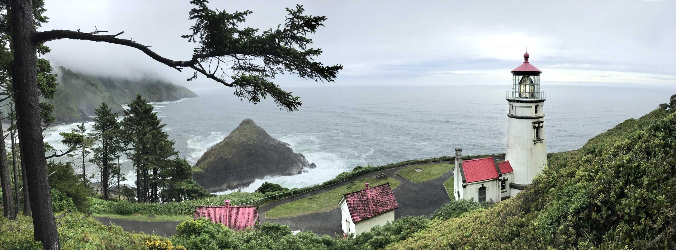
This headland’s name honors Bruno de Heceta, the Portuguese captain of a Spanish ship, who sighted the cape in 1775. The 1893 lighthouse was the last of Oregon’s dozen lighthouses to be built. The two-ton Fresnel lens has 640 hand-ground prisms.
Linger here to enjoy the view, and then head back to the Ponsler Wayside.
But wait — who was Muriel O. Ponsler? When you get back to your car, look for a bronze plaque. In 1939 Jack Ponsler donated the picnic area in memory of his wife. Back then most of the Oregon Coast was as quiet and undeveloped as this forgotten wayside. Today hikers who come here are willing to go the extra mile. I like to think that Muriel Ponsler was, too.
William L. Sullivan is the author of 23 books, including The Ship In The Woods and the updated 100 Hikes Series For Oregon. Learn more at OregonHiking.com.
