Despite Eugene’s tree-hugging reputation, there is no Wilderness Area within 50 miles — pretty much a record for Oregon cities. The best candidate to improve that dismal statistic is Hardesty Mountain’s undesignated wilderness, just 20 miles from town. Check it out with two short hikes from the same trailhead — a 0.7-mile climb to the viewpoint atop Eagles Rest and a 0.4-mile stroll down through old-growth woods to the Ash Swale Shelter.
The trailhead I’m going to recommend is on a paved, one-lane backroad that’s popular in summer with hikers headed to Mount June, a more famous summit in the Hardesty Mountain area. Mount June won its name because snow can block the trail there until June.
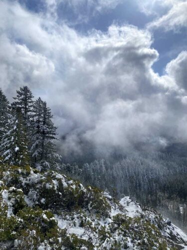
Eagles Rest is lower, at 3,022 feet of elevation. Even if a winter storm sweeps through in spring, as it did when I last visited, you’ll probably be able to drive to the trailhead on bare pavement. If you do find snow, it will be only in the last mile, so you could park and walk the rest of the way. A skiff of snow on the trees makes the hike even prettier.
To drive there from Eugene, take Interstate 5 south to exit 188A (for Oakridge), follow Willamette Highway 58 east for 11.4 miles to Dexter Dam, and turn right on Lost Creek Road.
Pause at this turnoff to notice the historic buildings on either hand. To the right is the Cascade Foothills Library, a volunteer project inspired in part by Ken Babbs, the Ken Kesey sidekick and Merry Prankster author who holds a library card with the number one. To the left is the Dexter Lake Club, the shabby red pub featured as a getaway for derelict frat boys in the cult classic movie “Animal House” and the current home of the Rattlesnake BBQ.
Stick to Lost Creek Road for 3.7 miles. Then watch sharp for a somewhat hidden blue sign for Eagles Rest Road on the left. Turn left across a bridge, follow a narrow paved road 5.7 miles, and park in a small parking lot on the right. The only marker is a tiny hiker-symbol sign where the trail to Eagles Rest begins.

The trail zigzags up through a Douglas-fir forest. The trees up here don’t seem very big, but they’ve never been cut. At the top, on a rock bluff surrounded by manzanita bushes, a single concrete pier remains from the 1922 fire lookout building. The view sweeps from Mount June across the clearcuts of commercial timberland (outside the National Forest) to the farms of the Lost Creek Valley and the South Eugene hills.
When you get back to the trailhead you’ll have hiked only 1.4 miles. Why not add a short stroll to a historic shelter? Simply walk across the road to find a trail that descends gradually through a forest of much bigger, 5-foot-diameter trees.
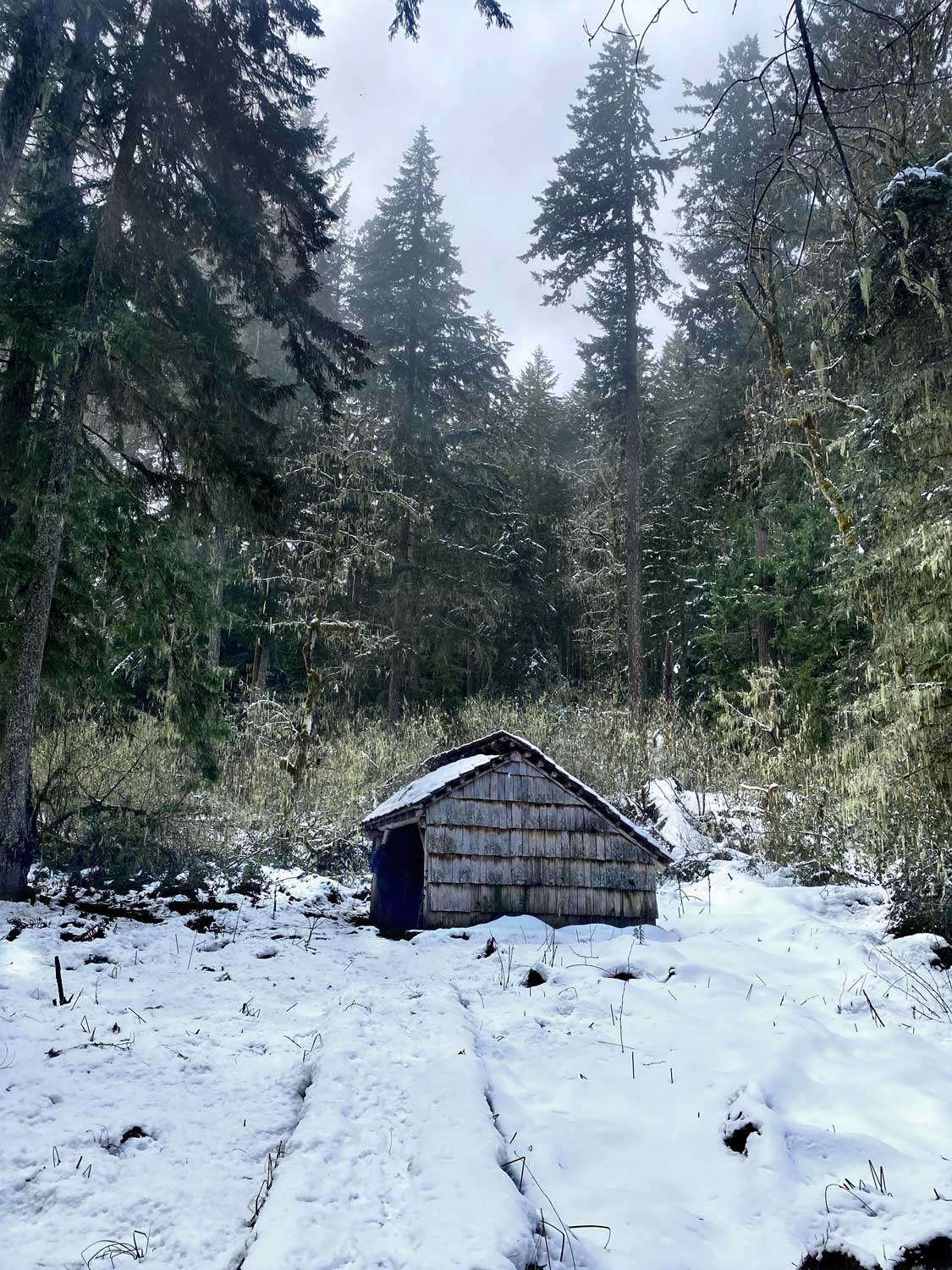
After 0.4 miles the path crosses Ash Swale, a bog where skunk cabbage put up huge, stinky yellow blooms in May. This seems an unlikely place for a shelter, but in the 1930s it was a stopover and watering place for horseback rangers on their way to the fire lookouts at Eagles Rest, Mount June and Hardesty Mountain.
After the original shelter was bisected by fallen trees, it was rebuilt in 1999. It’s still in good shape and open to the public for overnight use. I wouldn’t recommend it for more than a picnic stop. There’s no stove or firewood, so the three-sided hut would be a cold, damp place to camp in spring.
When I hiked there recently with Scott Hovis, a veteran trip leader for the Obsidians outdoor club, he said he couldn’t remember if he’d been there before. I pointed to the letters “HOVIS” scratched onto a roof beam with charcoal.
“Don’t do that,” I told him. He blushed.
Take only memories. Leave no trace. That’s the code of the wilderness, a mantra that is meant to preserve natural places where we are visitors, without the distractions of civilization. These are sacred preserves where we must be careful to leave no mark, so that others can see the world in all its untouched glory.
Why does Eugene have no designated wilderness nearby? Hike to Eagles Rest and the Ash Swale Shelter. Then ask that question again.
