There are no fancy lines on most maps delineating the Hardesty Mountain Roadless Area just southeast of Eugene. But thanks to the 2001 Roadless Area Conservation Rule, this nearly 7,000-acre area that spans the ridge between Hardesty Mountain and Mount June does get special treatment that protects its wild forests from commercial logging and other extractive development. These protections are tentative, however.
Prior to the Roadless Area Conservation Rule, logging roads and clearcuts carved out chunks from the otherwise intact landscape. If a recent proposal by the Trump administration to scrap the Roadless Rule moves forward, Hardesty Mountain would join 2 million acres of wild Oregon forests losing protection.
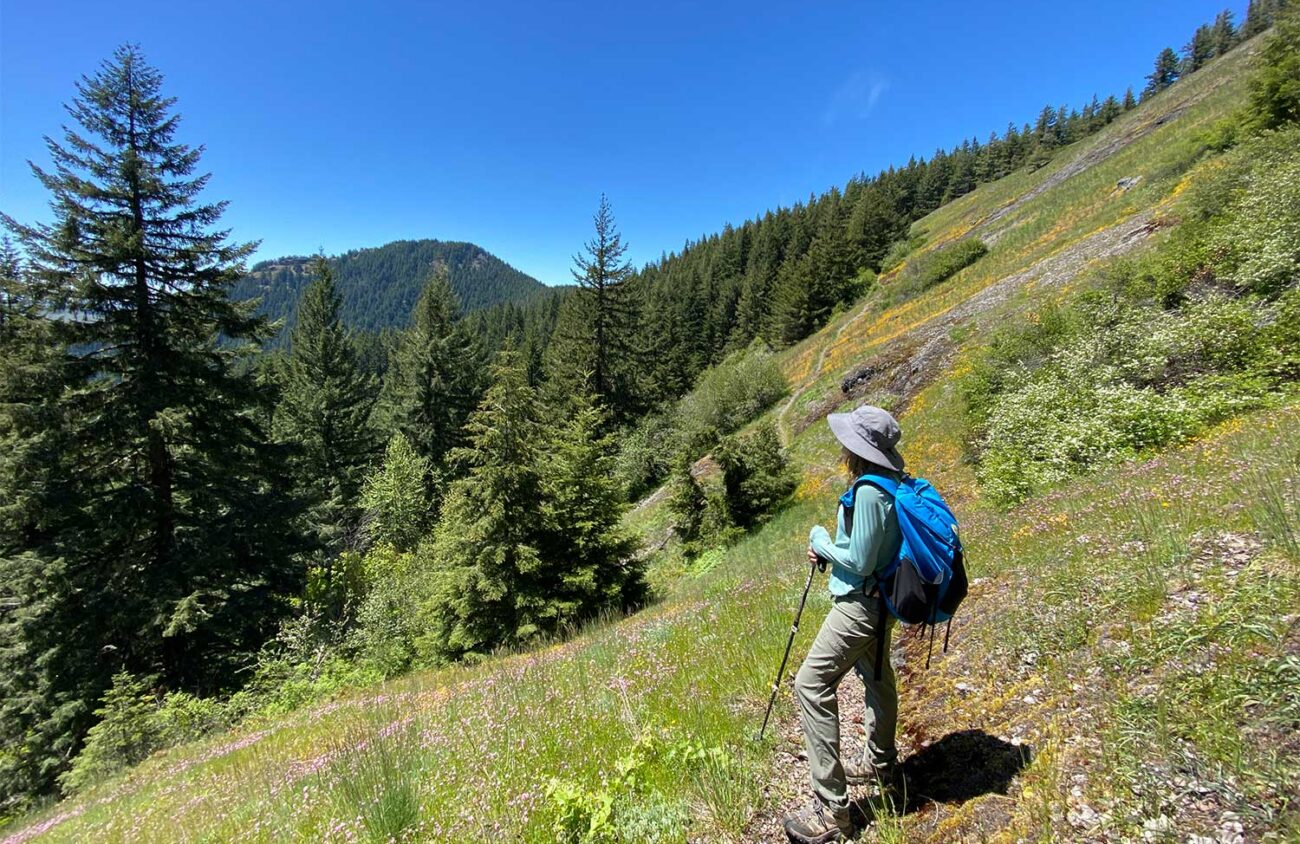
The best way to experience Eugene’s “backyard wilderness” is to hike to Mount June’s rocky summit for views over Layng Creek’s headwaters and distant Cascade mountains. Along the way, you’ll be treated to a forest full of birdsong and wildflowers.
The 1.5-mile hike isn’t long, but it is challenging. If you get winded, just take a few minutes to gaze into the canopy, listen to the lilting songs of hermit warblers and pacific wrens, notice the ferns and trailside wildflowers, and breathe. While wildflowers linger into early July, going soon will allow you to catch some trillium, fawn lilies and calypso orchids before they give way to other forest flowers like fringecup and coralroot orchids.
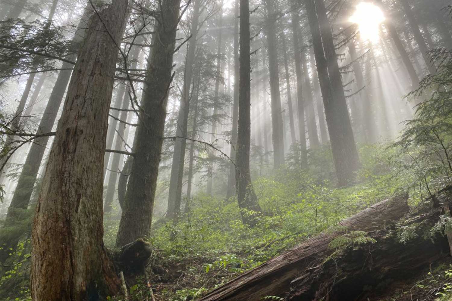
The first 0.7 miles winds through a beautiful forest of maturing hemlocks, with short uphill stretches alternating with gentler slopes. Note the evidence of the ancient Douglas-fir forest that was growing here before the last major fire — decaying snags, and a few remnant giants with branching tops high above.
At a junction, turn right to finish the summit hike. This section is much steeper and can feel like a slog, but a sunny opening part way up offers a good chance to catch your breath before the final push. Once on the 4,600-foot summit, you’ll be rewarded with a view eastward over the roadless area. In early summer, you’ll find a colorful mix of penstamons, stone crop and paintbrush at your feet in the rocky outcrops.
For more of a hike, head back to the junction and continue east on the Sawtooth Trail, adding on three miles round trip. The trail goes up and down, steeply in places, as it follows the ridge dividing the Middle Fork and Coast Fork Willamette watersheds. About a quarter mile past the junction look left to see red marked trees that delineate the boundary between Forest Service and Bureau of Land Management property.

While a chunk of BLM forests here are contiguous with the National Forest, they aren’t included in the “roadless inventory” covered by the 2001 Roadless Rule. These BLM forests remain vulnerable to logging plans.
After passing the Sawtooth Trail junction on the left, at 1.5 miles you’ll reach the steeply sloping meadow that includes Sawtooth Rock. Enjoy the wildflowers here and a view back towards Mount June before retracing your steps back to the trailhead.
It takes just over an hour from Eugene to the trailhead, thanks to a few miles of potholed and rough roads. (Did I mention the Forest Service’s $6 billion road maintenance backlog? Another reason not to build more roads in our wildest forests.) Careful driving and a vehicle with Subaru-or-better clearance is recommended.
From Eugene, take I-5 South to exit 188 to Highway 58 towards Oakridge. Drive 8.5 miles on Hwy 58 and turn right on Rattlesnake Road at the blinking yellow light. After 4.4 miles, this road merges onto Lost Creek Road (go straight at yield sign). Drive another 1.9 miles, then turn left over a bridge onto Eagles Rest Road. Pay attention to your mileage, as roads aren’t well-marked from here. Drive 7.8 miles and then stay left onto Forest Road 511 (or 20-1-14). Go 2.6 miles on pavement, and then 3.5 on gravel. Turn left on Road 1721 and go just 0.1 miles, then left on Road 941 for 0.4 miles to the trailhead.
An opportunity to weigh in on preserving the Roadless Area Conservation Rule is coming this month. Watch SaveRoadlessForests.com or OregonWild.org for the comment period announcement. Oregon Wild also offers an online Roadless Area Hiking Guide and interactive roadless map to help you find other at-risk forests to explore.
Chandra LeGue of Eugene is the author of the book Oregon’s Ancient Forests: A Hiking Guide and is the senior conservation advocate at the nonprofit organization Oregon Wild.